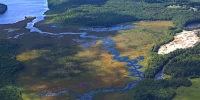
Conducting Easement Monitoring from the Air: Tips & Tricks
Join LightHawk to learn more about conducting aerial monitoring flights to survey your Land Trust’s conservation easements. Saving our partners on average 75 hours of staff time for every hour of flight, aerial easement monitoring is a great addition to your easement monitoring toolkit.
We’ll hear from Jeremy Puckett of Colorado West Land Trust and LightHawk volunteer pilot Robert Keller, Jr. about what has worked well for them, and how to best prepare for these types of flights.
Date: May 22
Time: 10am-11am MST
Cost: Free!
Webinar information will be sent to you via email after you register. A recording will be made available to all who register.
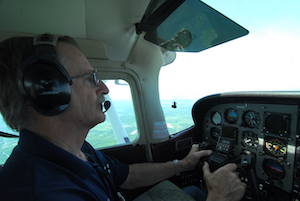
Jeremy Puckett Stewardship Director, Colorado West Land Trust
Jeremy holds a B.A. in Zoology, a M.S. in Environmental Studies, and a Graduate Certificate in Geographic Information Systems. His professional experience includes field biology, environmental education, conservation advocacy, environmental consulting, and county-level GIS mapping. As Stewardship Director for the Colorado West Land Trust, Jeremy has been on 12 flights with LightHawk since 2015. He consistently amazes LightHawk staff with his preparedness for these conservation easement monitoring flights and his understanding of General Aviation. The pilots he has worked with rave about what a pleasure it is to work with him.
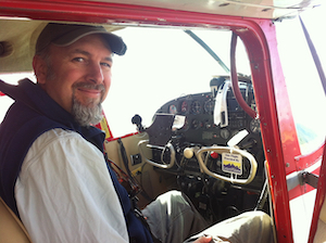
Robert Keller, Jr. LightHawk Volunteer Pilot
Bob joined LightHawk in 1994 after being one of the founders of Northern Wings, an organization that merged with LightHawk. He is one of our top-flyers, having completed over 200 flights for LightHawk since joining. Bob has been doing easement monitoring flights since joining, and is our go-to Easement Guru in the east. Bob is a part-time flight instructor and the Chair of the Board of the Tug Hill Tomorrow Land Trust in Northern NY, as well as a conservation easement landowner himself for his property in Booneville, NY. Bob brings all three perspectives to the table when conducting easement monitoring flights: as a pilot, land trust board member and an owner of conserved lands.