Flying Journalists Over Wyoming’s Iconic Landscapes – Pilot’s Perspective

The Boars Tusk – Used as a landmark for indigenous peoples, pioneers, hikers, railroad travelers, and countless other groups, this distinct feature is the core of a long dormant volcanic eruption. Photo by Vincent Tropéa.
Flying her very first mission for LightHawk, Volunteer Pilot Bronson Daughtry teamed up with fellow pilots Ray Lee and Matthew Machen to give partners from the Wyoming Outdoor Council an aerial tour over Wyoming’s Red Desert landscapes.
Before Bronson and the other pilots worked with Northern Rockies Program Manager Chris Boyer to discuss the partner’s objectives for the flight and plan the flight route. A few days out, she checked the weather to ensure that conditions would be safe and pleasant for passengers. While Bronson hiked and camped in the area before, this was her first time viewing it from the cockpit.
On the day of the flight, all three pilots spoke with passengers for a safety briefing and to determine the order the planes would fly. Bronson’s plane was the fastest, so she elected to be the last in the line, allowing her to keep an eye on the other planes as they traversed the area.

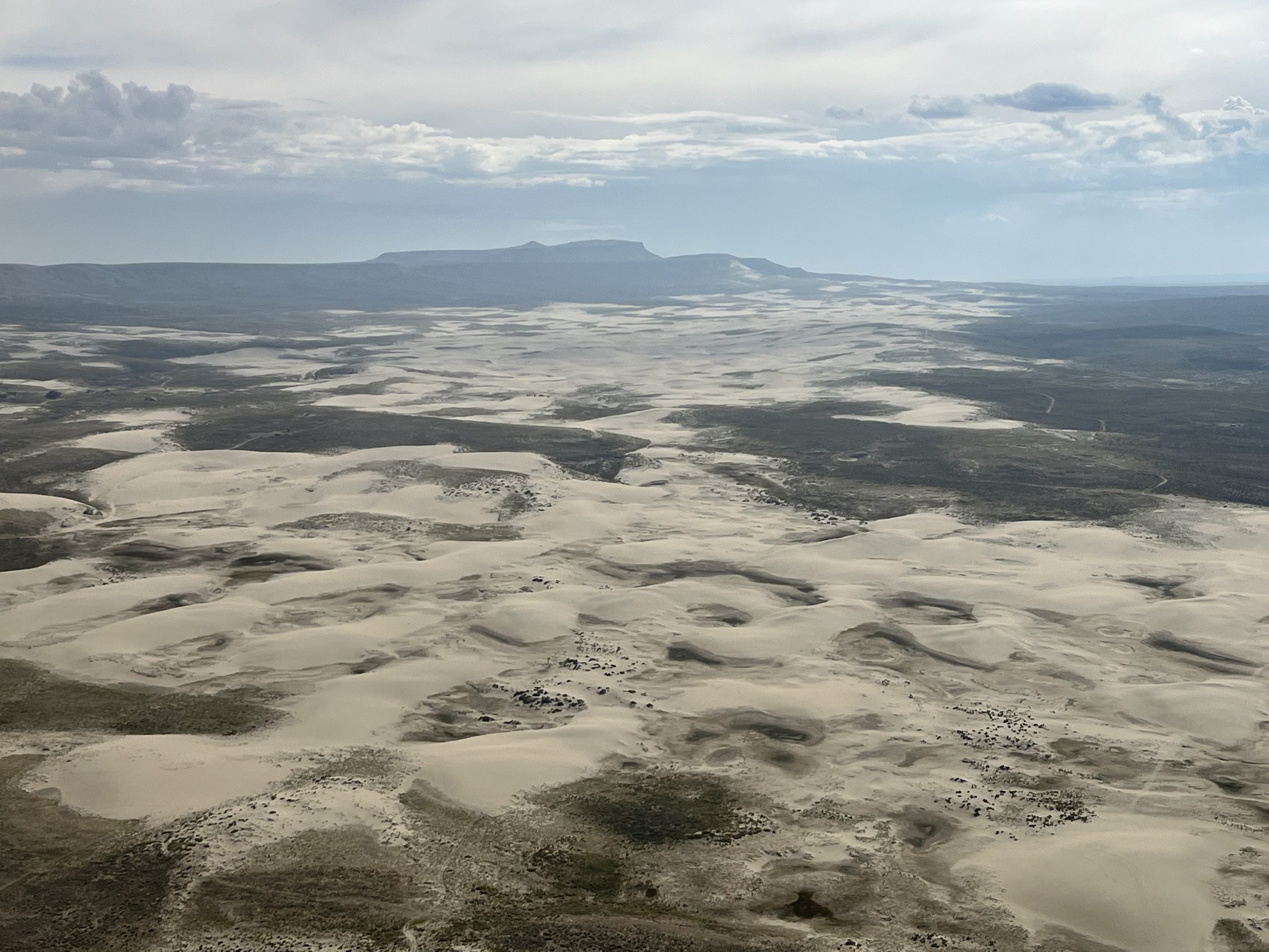
Flying over Wyoming’s Northern Red Desert region in the Wind River Range. Photo by Vincent Tropéa.

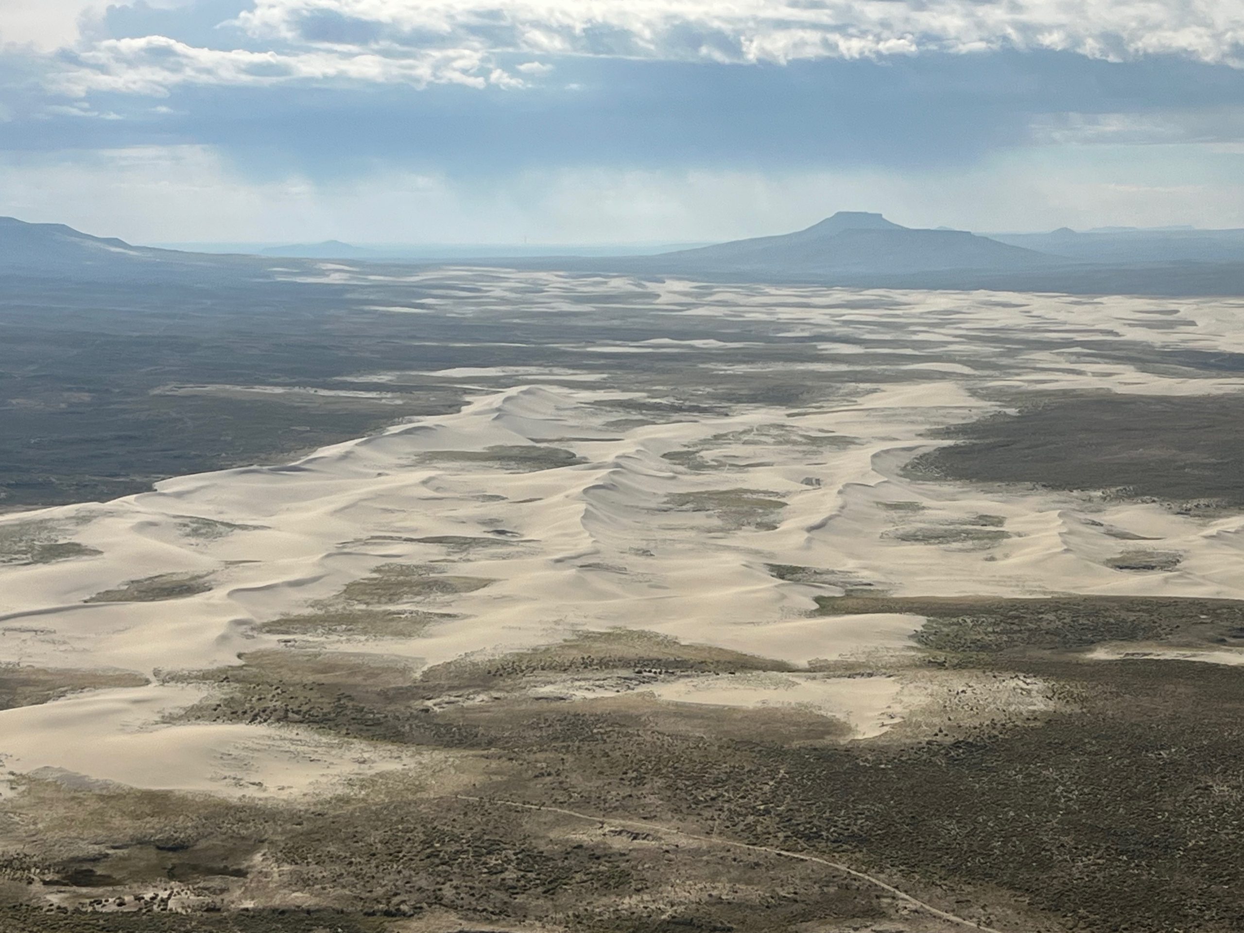
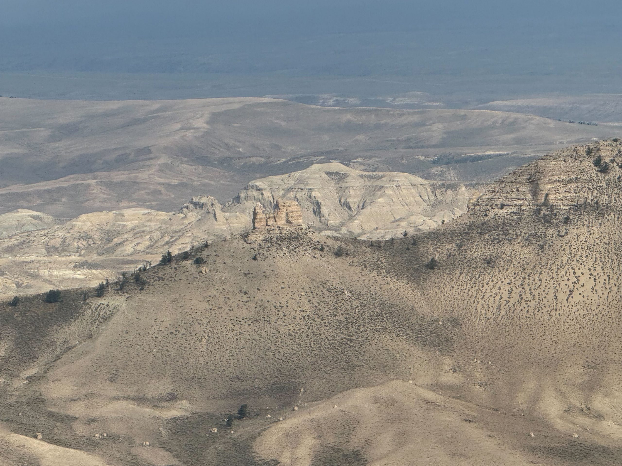
The Big Sandy Foothills of the Wind River Range in Wyoming are currently protected by the Rock Springs Management Plan but the current administration has signaled a desire to scale back those protections. Photo by Vincent Tropéa.
Once airborne, she cruised higher than the other planes, staying at about 1,000 to 1,500 feet above ground level, giving her a margin of safety in the mountainous terrain. She kept her airspeed between 80 and 110 miles per hour. “It was just a blast to follow the other two pilots because they had flown there before,” she said. “It was nice to have a guide in a sense. The two people in the plane were super knowledgeable. They pointed out everywhere we were going. That was really fun, to be able to see everything and hear their stories about the land, especially learning about Boar’s Tusk.”
While the three planes were following the same route, they kept a mile to a mile and a half apart, maintaining safe distance while giving them the same views of the desert below. The flight lasted a little over an hour, providing passengers an opportunity to see the immensity of the landscape and gain a new perspective of their conservation work.

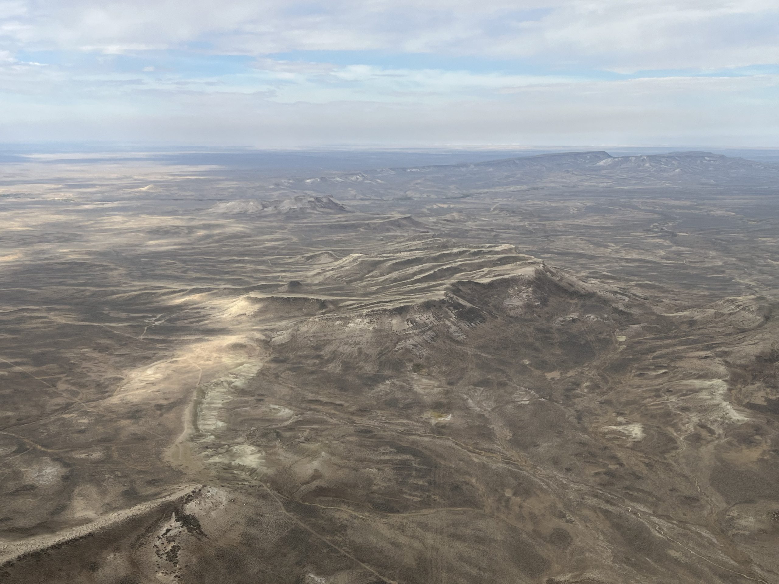
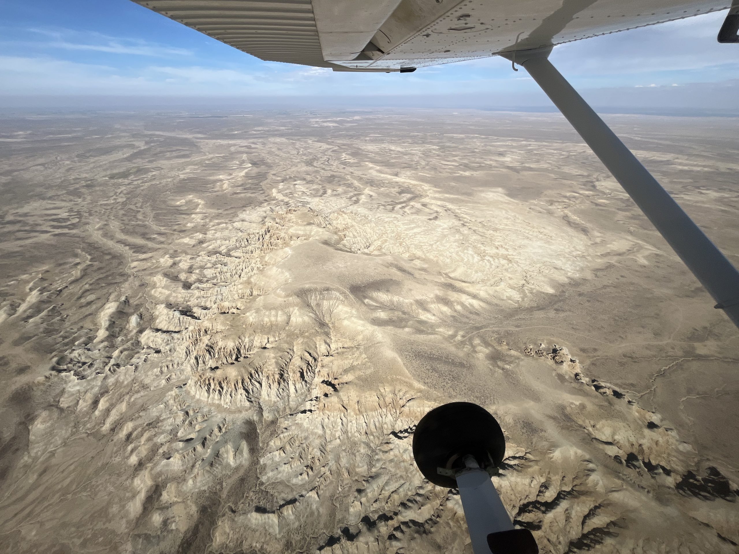
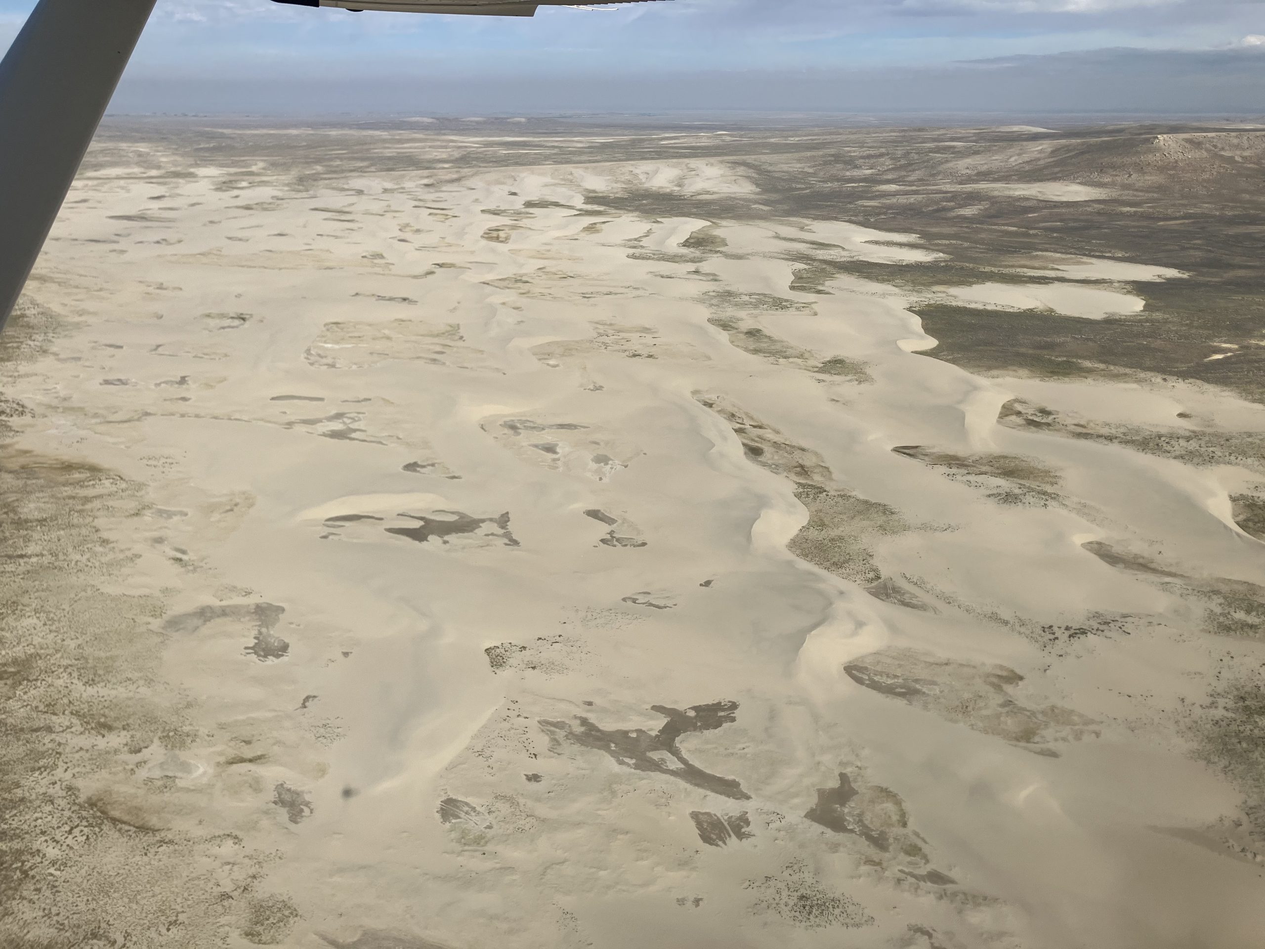
Flying over sand dunes in Wyoming. Photo by Dustin Bleizeffer.
Bronson told her passengers before the flight that their comfort was her top priority and they could turn back at any point if they were uncomfortable. No one had any issues, and as she put it after the flight, “They were the best passengers ever!” One of those passengers, Joseph Quiroz of the Wyoming Outdoor Council, shared afterward, “The flight was indispensable in creating an initial image of the immensity and diversity of the landscape. It was my first time flying over the Red Desert in a light craft and I was surprised to see how so many features looked from the air. And this is after 20 years of land travel out there. For me personally, it has really broadened my appreciation of the place and puts me in a better position to advocate for the conservation of the Red Desert. Thank you very much for making this possible.”
A huge thank you and congratulations to Bronson for completing her first LightHawk flight, as well as to pilots, Ray Lee and Matthew Machen, for joining forces to make this mission possible. We can’t wait to see where Bronson flies next!
Photos by Dustin Bleizeffer and Vincent Tropéa.