Preserving Pacific Flyway habitat for Sandhill Cranes

Sandhill Cranes in a flooded agricultural field along the Pacific Flyway in Central California. Photo: Robert Steelquist | Pilot: Louise Mateos
There’s one thing for certain when you take to the skies – once you leave the ground, you’ll eventually need to land. That’s not just true for our volunteer pilots. It’s also true for our feathered friends. For Sandhill Cranes flying through Central California, agricultural fields are a vital part of their migratory journey.
Photographer Robert Steelquist set out to document the habitats they depend on for rest and food. Volunteer pilot Louise Mateos provided the flight, giving him a bird’s-eye view of the Central Valley farmlands.
Louise joined LightHawk’s volunteer pilot ranks early in 2025 and immediately began making an impact – flying three missions throughout the year and volunteering for several more. Flying out of Palo Alto, California, she landed in Stockton to pick up Robert for the photography mission. Her Cessna 182 has bubble doors, making it an excellent photo platform.

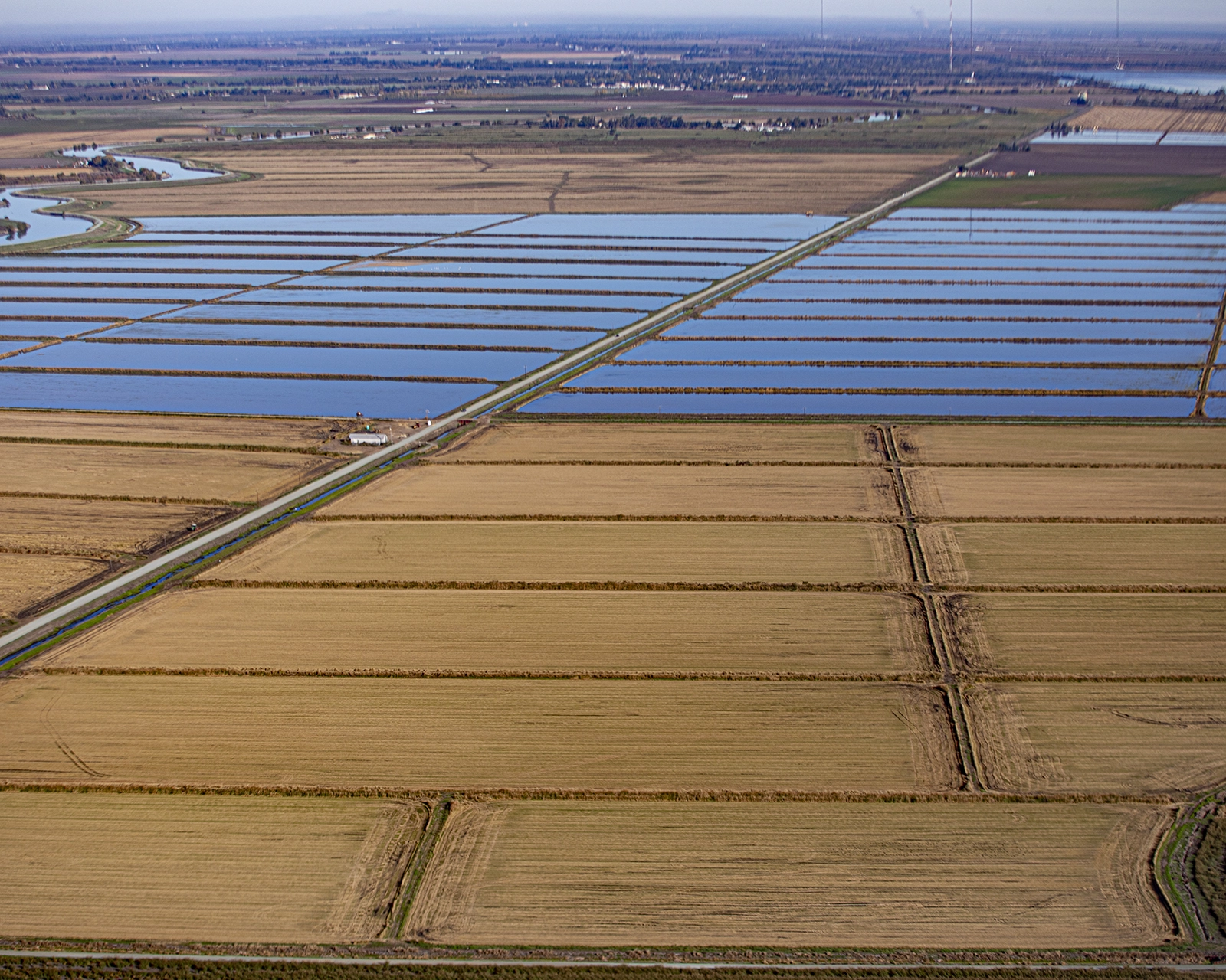
Sandhill Cranes use agricultural fields to rest and feed during their mingration. The loss of these lands could be catastrophic to their ability to make the journey. Photo: Robert Steelquist | Pilot: Louise Mateos

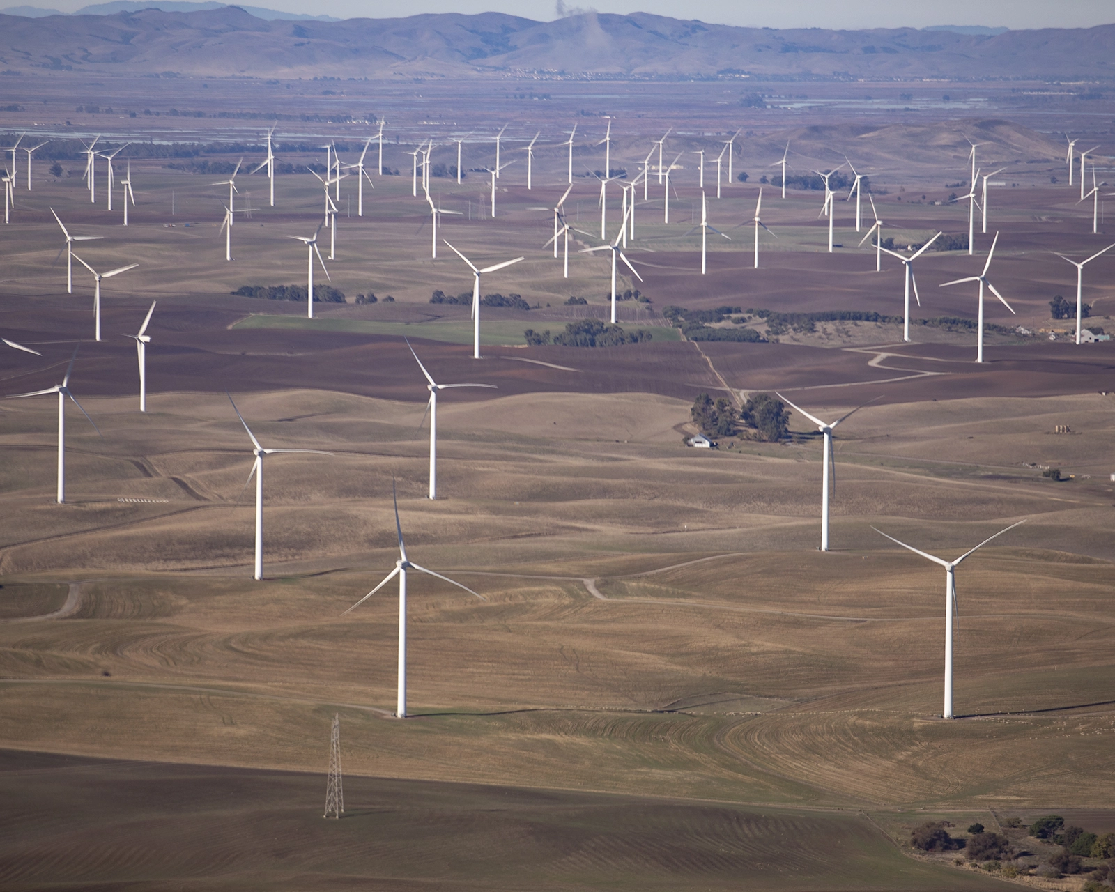
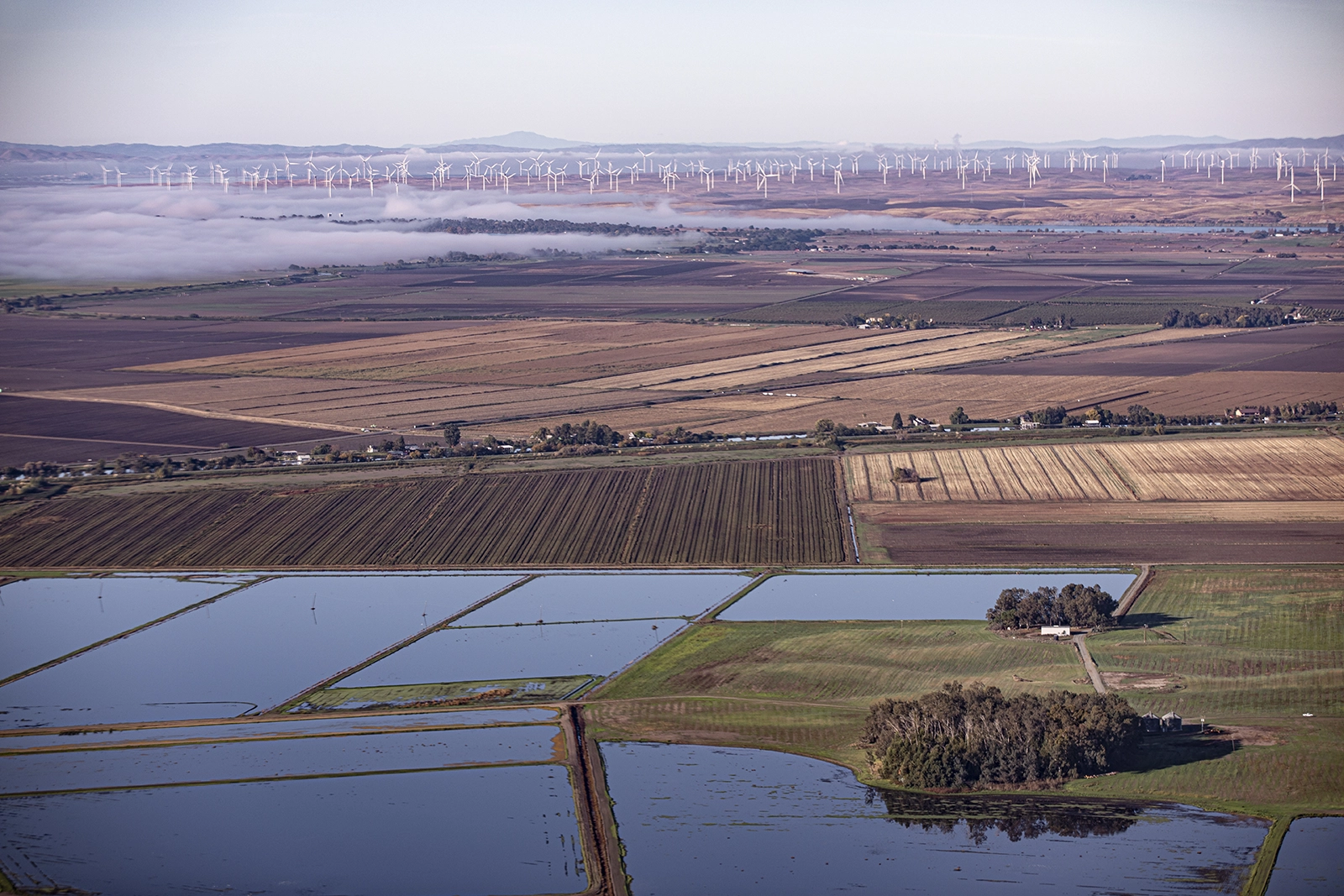
Migratory habitat is under constant pressure from things like climate change and increasing urbanization. Photo: Robert Steelquist | Pilot: Louise Mateos
Ahead of the flight, they discussed the areas Robert wanted to cover and the altitude at which they would fly. They agreed staying 1,000 feet AGL would work well for the flight’s goals, though they could go a bit lower if they found it necessary. They also discussed staying higher or avoiding areas where birdwatchers were observing cranes so as not to disturb them.
The flight itself went smoothly with Robert able to capture a number of fantastic images of the Pacific Flyway in the Central Valley – an area that faces threats from climate change including reduced water availability, sea level rise, shifting agriculture, and rapid urbanization. They flew along corridors around I-5 and US-99 from Stockton to Sacramento. They also flew over by Rio Vista, California to capture photos of windmill farming.
After landing back in Stockton, Robert shared, “The LightHawk flight proved a very effective way of gaining perspective on the landscapes of the Sacramento Delta and the challenges facing wildlife—specifically waterfowl—managers and conservation organizations. The experience helped me refine my equipment and methods for capturing landscape-scale aerials. This photography will be shared with biologists working on a new Central Valley conservation plan for cranes in the hope that my pictures can document critical threats to cranes and habitat conservation.”

Farm fields provide both food and places of rest throughout California’s Central Valley. Photo: Robert Steelquist | Pilot: Louise Mateos

Urban development encroaches on prime Sandhill Crane habitat, reducing the space available for the birds during their migration. Photo: Robert Steelquist | Pilot: Louise Mateos
Louise Mateos spent most of her career as an aerospace engineer for Lockheed Martin. Since retiring, she has spent her time as a CFI, logging an incredible 320 flights in 2025. She also flies for the Civil Air Patrol, providing emergency services when needed, as well as conducting check rides for mission pilots. She is the Deputy Commander for the San Francisco area and now serves as Deputy Commander for all of California.
Thanks to both Louise and Robert, Sandhill Cranes advocates have better information and imagery needed to persuade local leaders and decision-makers to protect their section of the Pacific Flyway, ensuring these birds have places to land, rest, and continue their migration.

Photos: Robert Steelquist | Pilot: Louise Mateos