Mission of the Month: Flying Journalists Over Wyoming’s Iconic Landscapes
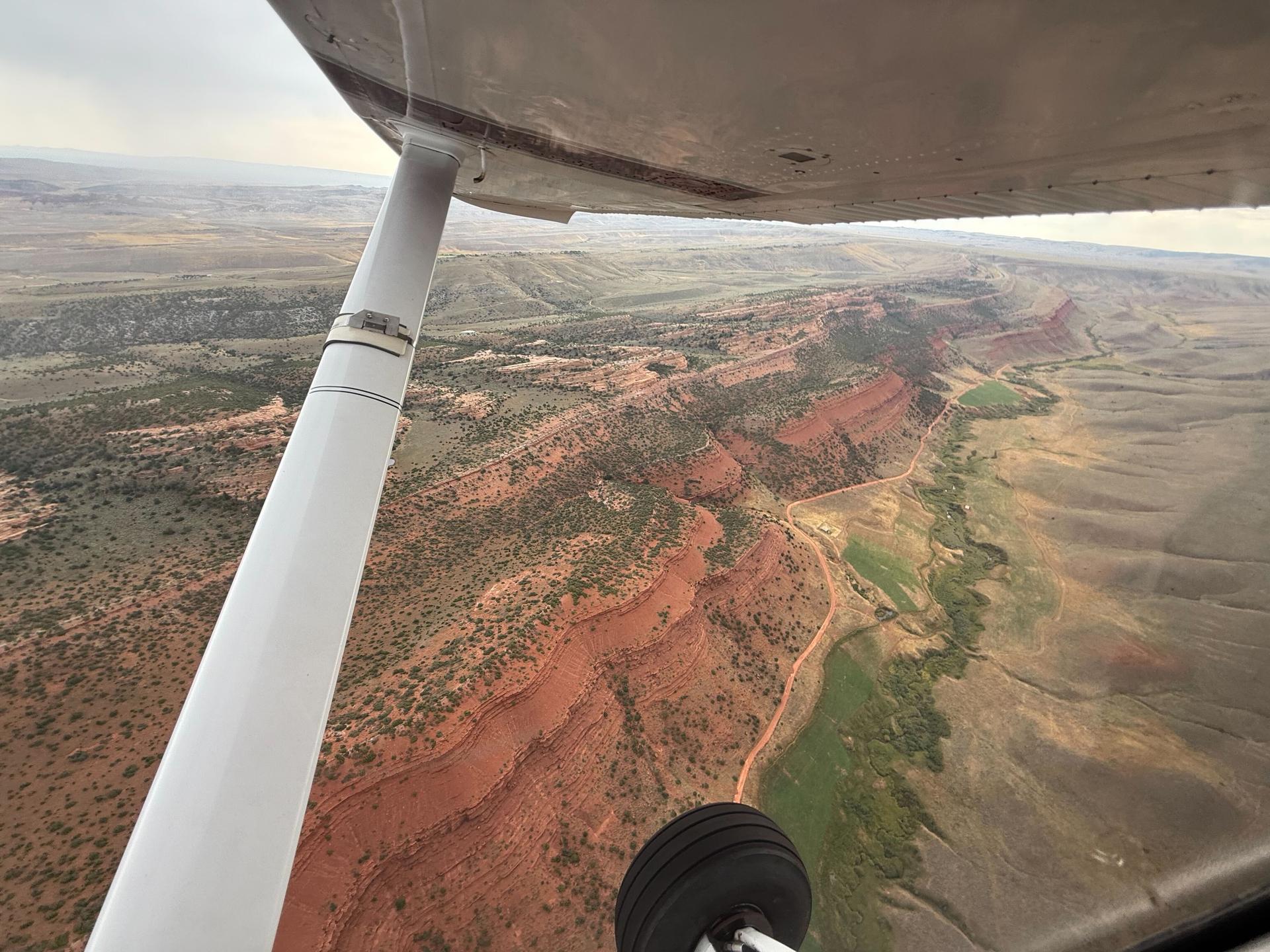
Flying over Wyoming's Northern Red Desert region in the Wind River Range. Photo by Vincent Tropéa.
The Northern Red Desert and Big Sandy Foothills of the Wind River Range in Wyoming are considered some of the most ecologically significant lands in the lower 48 states. They provide habitat for the world’s highest density of sage grouse as well as home to pronghorn, mule deer and other species. These lands also hold deep cultural significance for many tribal nations, with sacred sites and the traditional homelands and hunting grounds of the Eastern Shoshone.
Although the Rock Springs Management Plan currently protects the area, recent federal actions could weaken those protections to allow for more oil and gas development. That’s why LightHawk partnered with the Wyoming Outdoor Council to conduct a media tour of the region, giving reporters an aerial view of the landscapes at risk.
LightHawk In The News
- More public comments accepted on South32 Hermosa Mine permit: New minerals added to 'critical' list
- Ameren plans largest solar facility yet next to Callaway nuclear plant, in part for data centers
- Colorado River deal is ‘tenuous’ just two months before federal deadline, negotiator says
- Here's to LightHawk!
- St. Louis considers data center ban, following St. Charles' lead
- Florida takes over major Everglades restoration project from Army Corps
- Pueblo governors head to D.C. to advocate for keeping Chaco Canyon buffer zone banning oil drilling
- Native leaders in New Mexico campaign to protect Chaco Canyon from oil and gas drilling
- Mississippi River mayors want FEMA reform to include wetlands to fight floods
- Mississippi River mayors want FEMA reform to include wetlands to fight floods
Photo of the Month
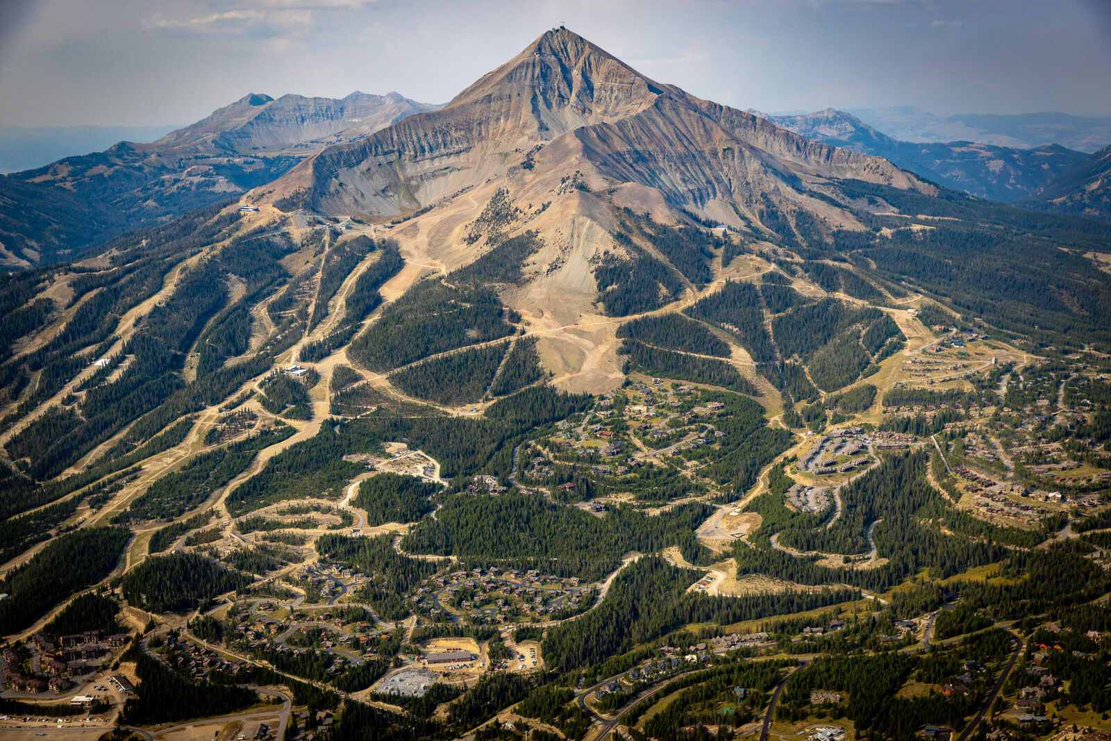
Photo by Chris Boyer
LightHawk partnered with the Greater Yellowstone Coalition to conduct an aerial tour of landscapes covered by the proposed Greater Yellowstone Conservation and Recreation Act (GYCRA). The flight, provided by LightHawk Volunteer Pilot Paul Oliver, included journalists and project partners. The photo, captured by Chris Boyer, depicts Big Sky Resort in Montana. Our partners will use imagery from the flight for social media, to share with news outlets, to gain traction with the public and the entire Montana delegation in sponsoring GYCRA. This was Paul's first flight for LightHawk.
Inspiring Action
Your Support Builds Momentum for Lasting Change.