Mission of the Month: Restoring Wildlife Connectivity Through an Aerial Perspective
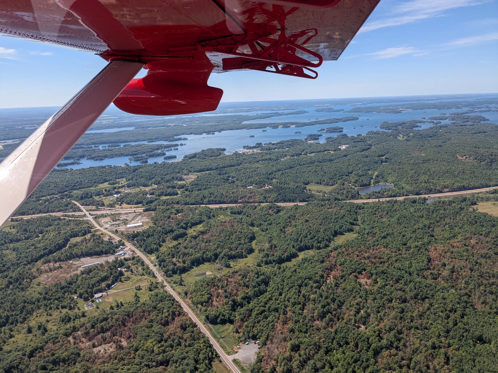
The Algonquin to Adirondacks (A2A) Collaborative gained a new perspective on ecosystem connectivity on a recent flight with LightHawk. Photo by Jess Lax.
From highways to property boundaries, humans are experts at drawing lines across the landscape. But for wildlife, those lines don’t exist, and the consequences can be deadly. That’s why LightHawk and our partners are taking to the skies to show what’s at stake.
One of those partners, the Algonquin to Adirondacks (A2A) Collaborative, is working to reconnect habitat and strengthen ecological connectivity across the region. Spanning from Ontario’s Algonquin Park to Adirondack Park, through the Frontenac Arch and surrounding lands, the A2A region is one of the last intact natural linkages in Eastern North America. Its forests, wetlands, and waterways support a remarkable diversity of life, from black bears and moose to rare birds and plants.
A recent LightHawk flight, provided by volunteer pilot Adam Goldstein, gave A2A members a new perspective on the Highway 401 corridor in southern Ontario. From above, they captured photos and video that will be used to raise awareness with constituents and policymakers about the urgent need for wildlife crossings.
LightHawk In The News
- Will Trump's 'Big Beautiful Bill' help farmers in the Midwest and Great Plains? It depends
- Tracey Weiss, Our Ocean Backyard | Coming soon: Opening the gates to Cotoni-Coast Dairies
- Fort Collins pilot volunteers his own plane, time and money to fly conservation missions
- Environmental groups sue Arizona water agency over Benson mega-development
- LightHawk Flight to Cape May
- The Calm Before the Migration
- LightHawk Conservation Flying – Arizona Project Update
Photo of the Month
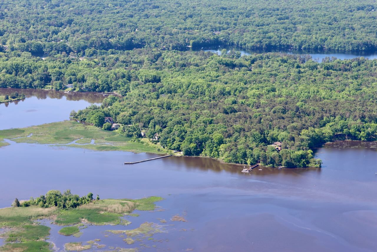
Photo by Jim Wright
This gorgeous photo was captured by Jim Wright - The Nature Conservancy New Jersey on an early summer LightHawk flight designed to capture photos of the Meadows or Garrett preserves. The flight was a success and the imagery Jim collected will be used by The Nature Conservancy to educate and inspire protection of critical habitats. This flight was donated by volunteer pilot Julie Boatman Yeates.
Inspiring Action
Your Support Builds Momentum for Lasting Change.