
Crews work to extend a boat ramp at Bullfrog Marina at Lake Powell, where water levels remain low. Photo by RJ Sangosti/Denver Post.
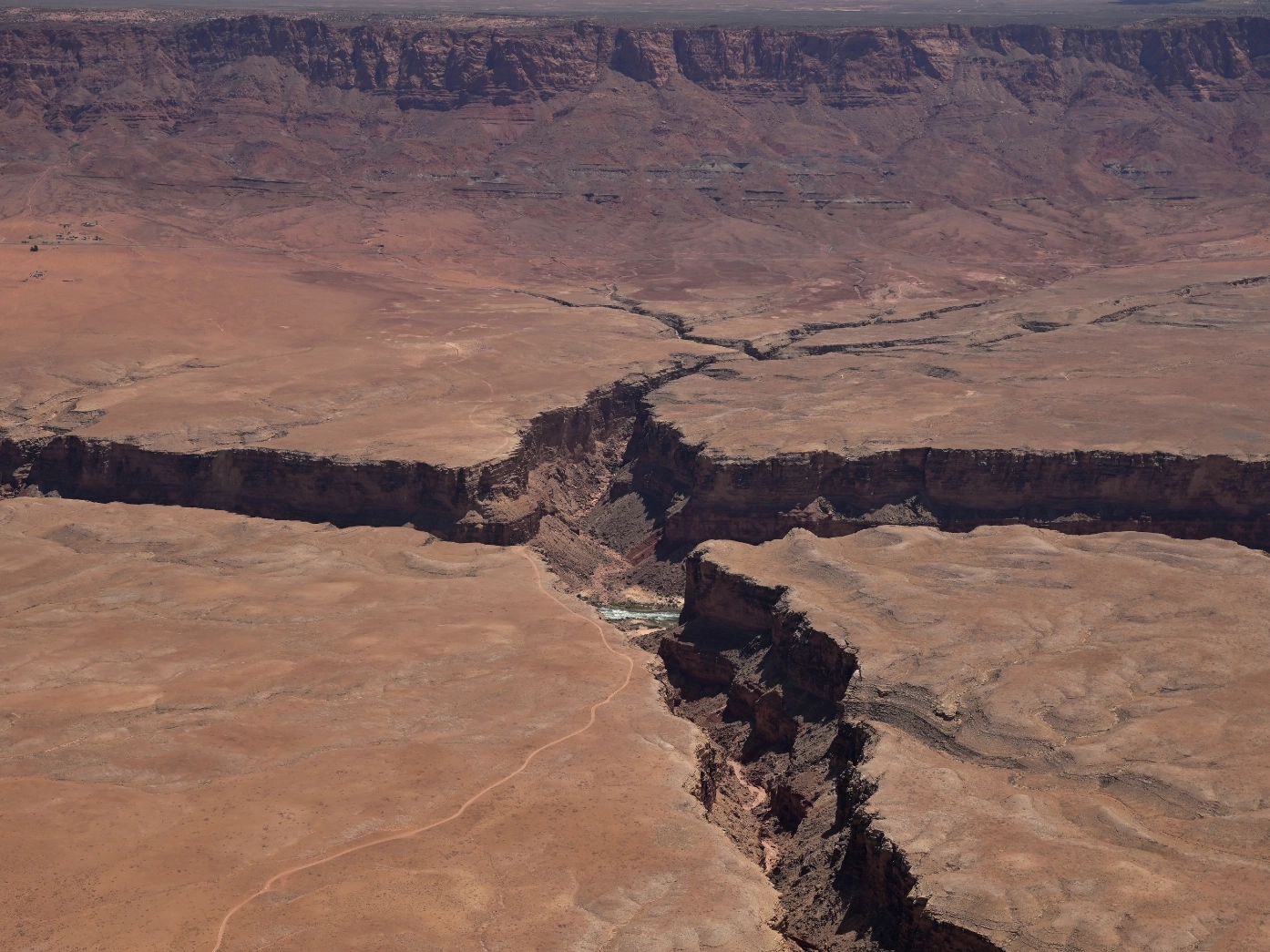
The Colorado River Basin is an area of intense interest this year. Record low snowfall has left the river system with very little water, highlighting the ongoing water crisis in the West. Massive reservoirs like Lake Mead and Lake Powell are far below their average water levels.
With increasing demand for flights over the basin, we are fortunate to have volunteer pilots like Chuck Schroll. Chuck has flown for LightHawk for many years and has been active this summer in flying members of the media and researchers over the Colorado River.
At the end of April, Schroll took to the sky with Denver Post journalist RJ Sangosti to document the conditions of the river and Lake Powell. Sangosti has flown with LightHawk previously, documenting much of the Colorado River basin, from headwaters to the delta.
When asked what draws him to missions like this one, Schroll responded, “The flights are beautiful and water is a big issue. And Betsy calls me! These people that are fighting the water issues, that’s big time important and I’m honored to be part of the work.”

If water levels far beyond minimum power pool, dams like the Hoover Dam will not be able to function, potentially cutting off power for communities across the southwest. Photo by RJ Sangosti/Denver Post.

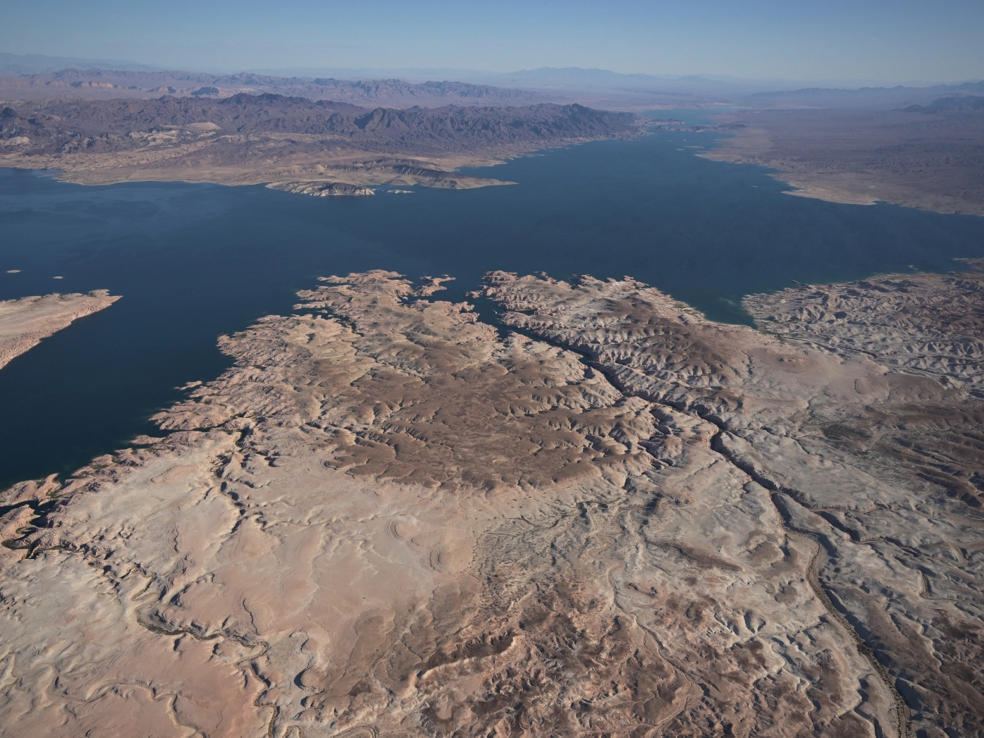
As drought conditions in the Southwest worsen, there are concerns Lake Powell could drop below “dead pool,” when hydroelectric power generation would no longer be possible. Photo by RJ Sangosti/Denver Post.
Planning is a big part of these flights before they leave the ground. Schroll shared a little about the process, “Betsy gets us together on a Zoom call. We talk about the objectives and the route and we say what’s possible, what’s not possible and what may be better. Flying in the early morning is the best.”
Beyond the basics, many areas of the Colorado River basin require extra awareness by pilots. Schroll said, “There’s a lot of military restricted airspace which you either can’t fly in or you got to get permission to fly in. And then there’s temporary flight restrictions, especially in fire season which is year-round now with the dry and the heat, there are restrictions where they’re fighting the fire and you can’t fly into that.”
“For media flights like this one, dialing in the right altitude is important. Too high and the detail on the ground disappears. Too low and the overall perspective is lost. “We fly at one or two thousand feet above the ground. Generally, there’s no reason to fly below 1,000 feet. You can legally fly lower, but you get a pretty good perspective (from 1,000 feet). Or if they want a bigger picture we go to even 3,000 feet above the ground,” Schroll said.
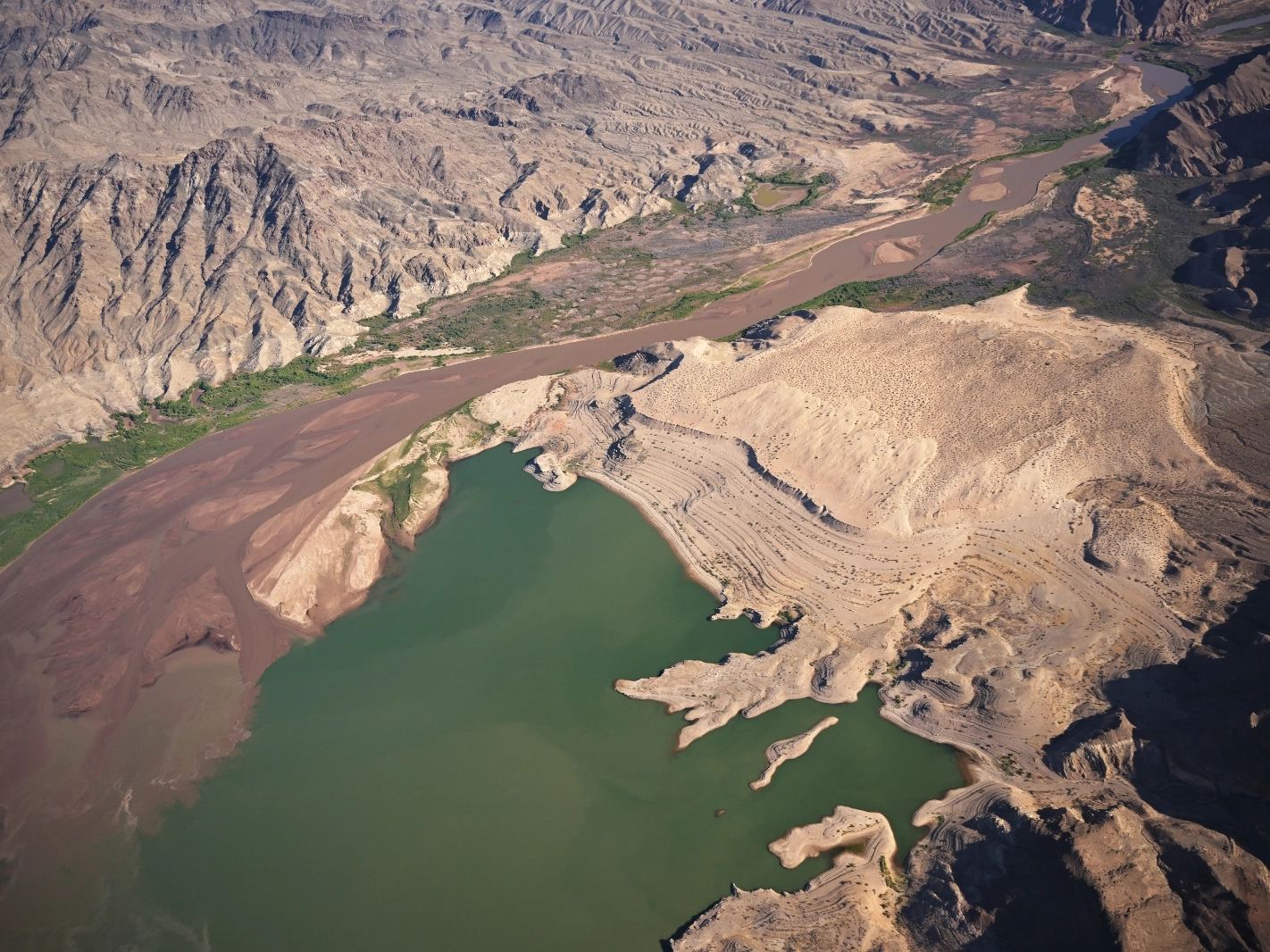
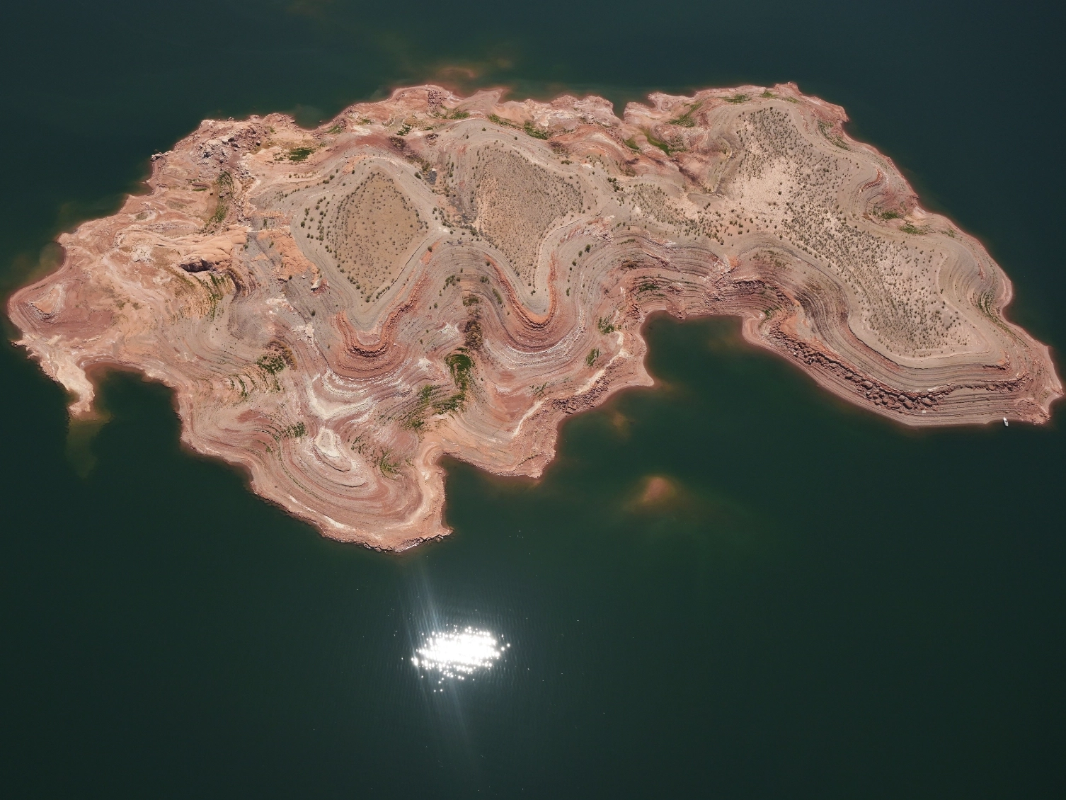
Flying over Lake Powell, the impacts of a long drought are obvious. He noted, “They call it the bathtub ring where the water levels used to be and it is way, way down. Last time I flew I remember a boat ramp up near the northeast corner of Lake Powell. Now the boat ramp goes nowhere near the water.”

Water levels along the basin are reaching critically low levels, threatening the ability to produce hydroelectric power. Photo by RJ Sangosti/Denver Post.

The “bathtub ring” shows how far the water levels have dropped within Lake Powell. Photo by RJ Sangosti/Denver Post.
After the flight, journalist RJ Sangosti shared, “I’m very thankful for the support of LightHawk for my continuing coverage of the Colorado River basin and I’m thankful for the generosity of the pilots that have helped me in the past and the generosity of Chuck on this current flight. Chuck came from Tucson pick me up in Boulder city near Las Vegas, flew for four hours, dropped me off and then flew back home. I can’t ask for a better experience in a better pilot for this trip.”
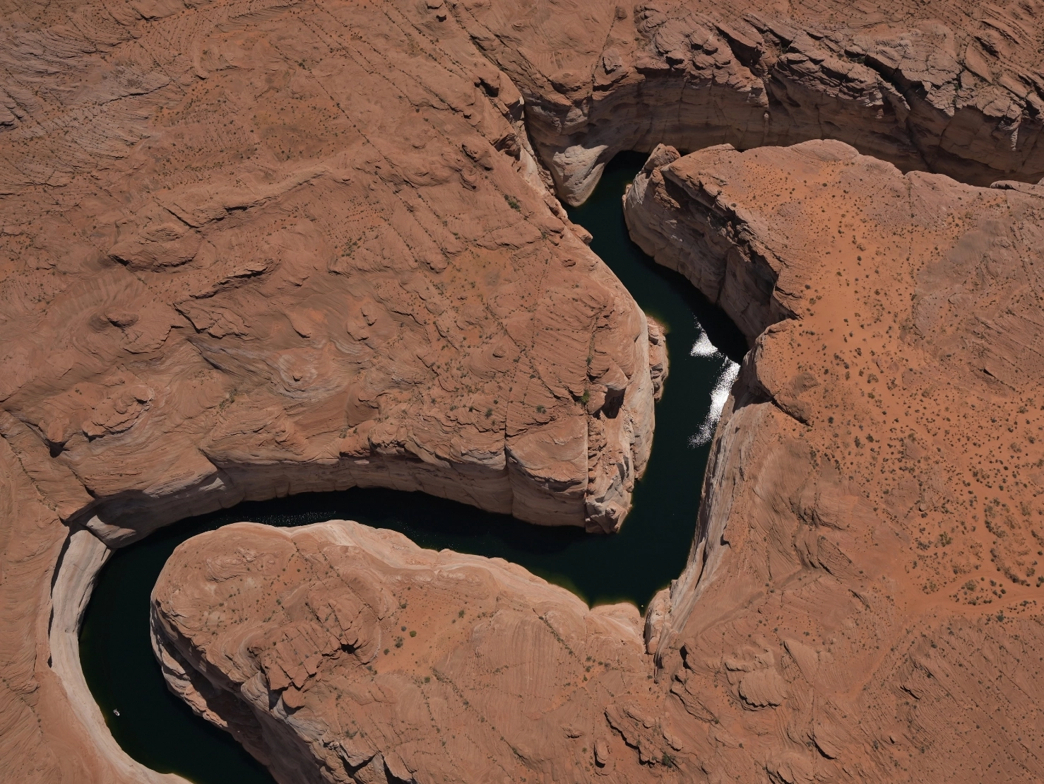
The photos collected as part of this flight will be used to illustrate stories about the water crisis currently facing the West. The aerial perspective shows how a lack of water is impacting the water system in a way that ground-level images can’t achieve.
Flying a 1969 Cessna 206, Schroll stays busy flying LightHawk missions. Since this flight, he has completed two more over the Colorado River basin, highlighting how much attention this year’s water levels are receiving.
When asked about why he flies for LightHawk, Schroll shared, “People say, there are already pictures of this, and drones can take a look but there’s nothing like seeing it with your own eyes. A photograph often doesn’t give you the big picture. People get up in an aircraft and look down and say, ‘I didn’t know that was right by that road I drive all the time.’ Or ‘this is my neighborhood.’ Or ‘I’ve been here before on the ground, and I didn’t know it looked like this.’ If you’re seeing it with your own eyes you can place yourself there and get the big picture.”
He went on to say, “ My favorite parts (of flying for LightHawk) are just seeing everything and then learning from the people I’m flying with. That makes it all worthwhile.”
We’re thankful for Chuck’s dedication to LightHawk’s work and his continued generosity of flight time.
Photos by RJ Sangosti/Denver Post.