Surveying Boat Impact on San Juan Islands Seagrass

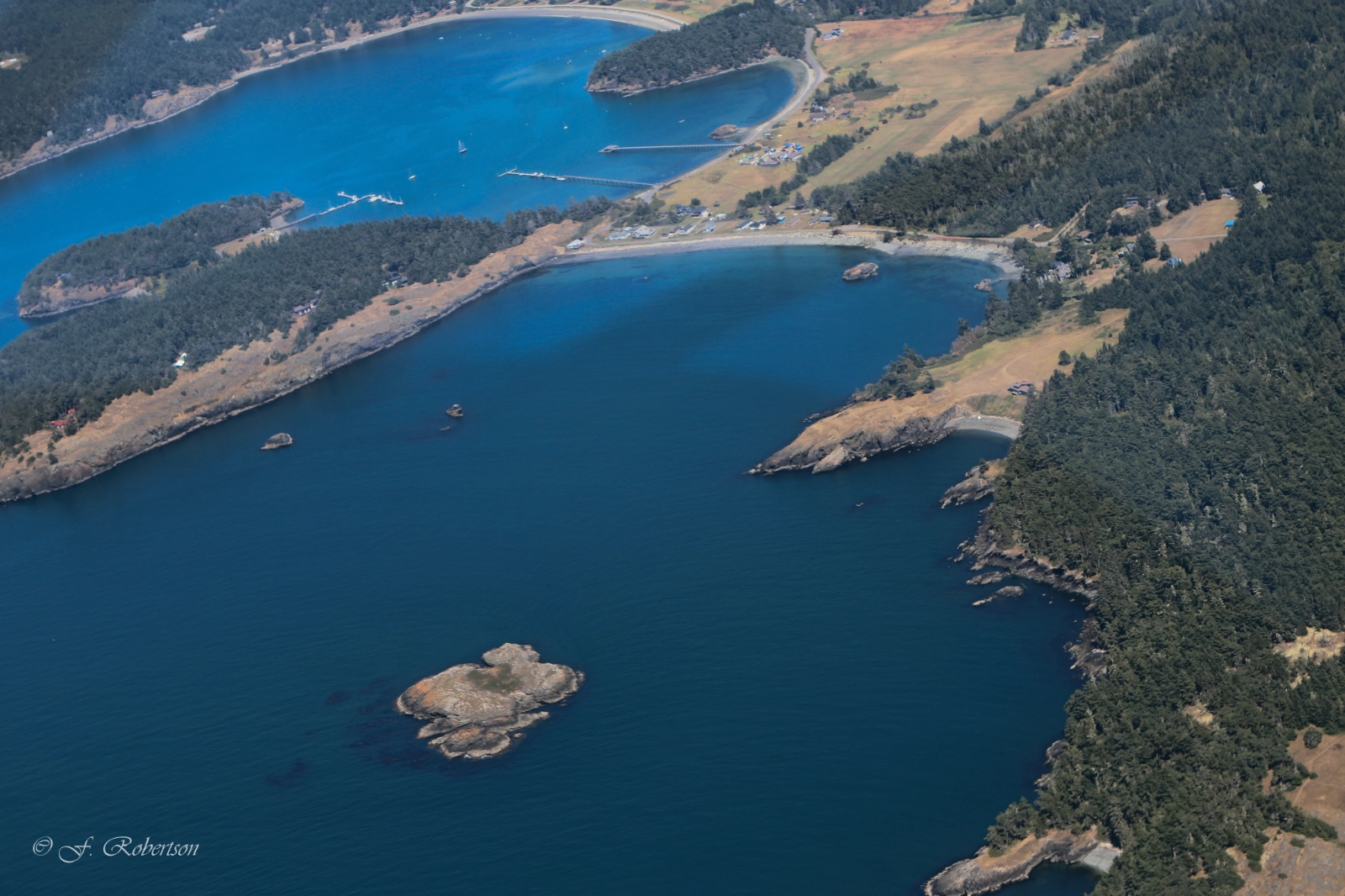
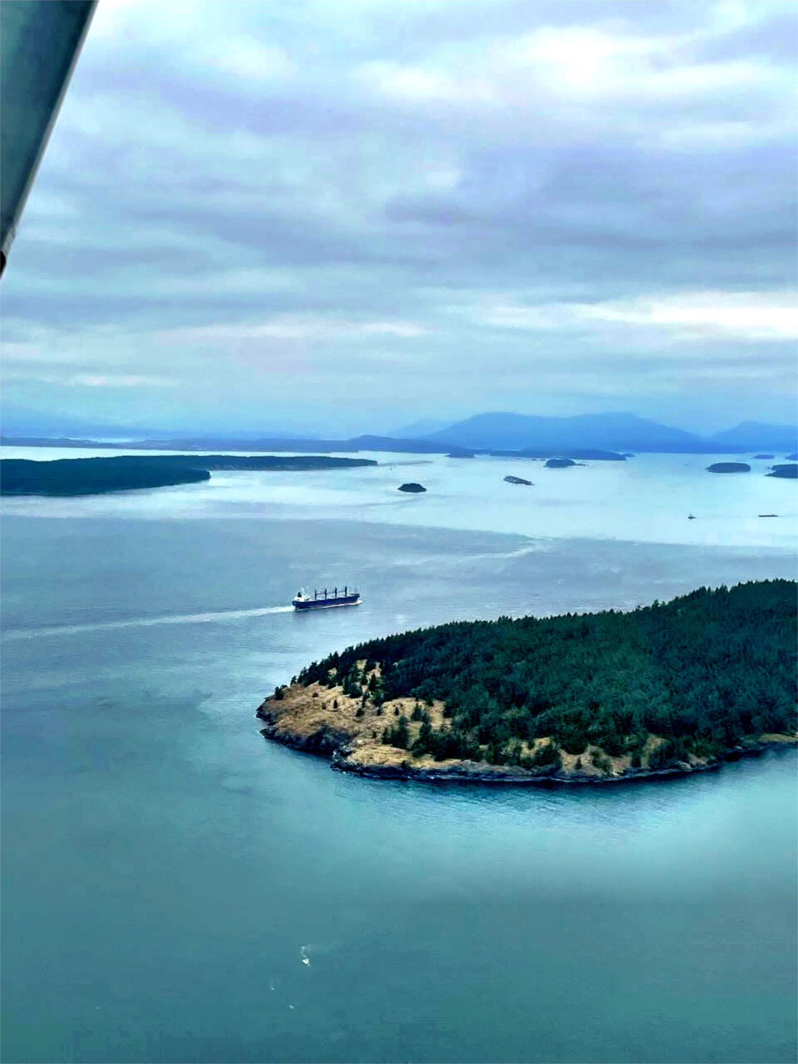
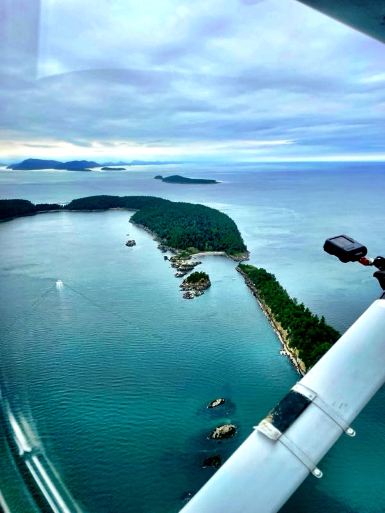
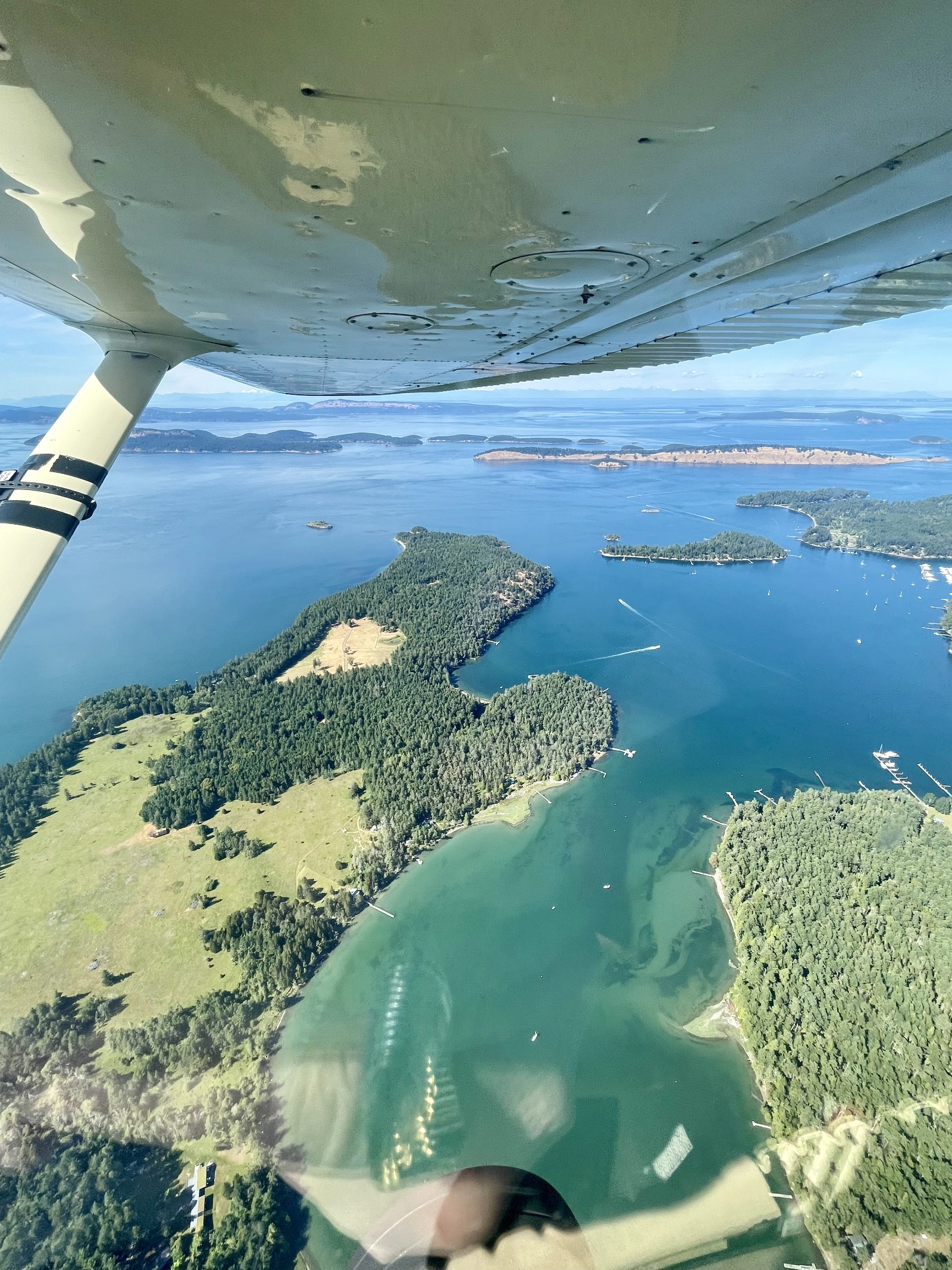
Flying above Washington’s San Juan Islands gives researchers a platform to survey boat traffic and how it may be impacting sea grass beds that are vital to marine wildlife. Photo by Frances Robertson.
Starting in 2025, LightHawk began working with the Washington State Department of Natural Resources to conduct aerial surveys assessing the impact recreational boats have on sea grass beds around the San Juan Islands.
The San Juan Islands are a stunning collection of offshore landscapes that draw visitors from across the region and beyond. Chief among the draw are orca whales, which traverse the waters of the Pacific Northwest as they migrate between feeding grounds, bringing thousands of visitors to the San Juans each year hoping to catch a glimpse.
Now in its second year, the project relies on a small team of LightHawk pilots flying transects across multiple islands and anchorage areas to collect data biologists use to understand, and protect, the sea grass beds vital to the islands’ marine ecosystem.
“LightHawk has become a critical partner in our ability to implement this type of monitoring and data collection,” said Frances Robertson, a biologist with WADNR.
Lane Gormley is one of LightHawk’s most dedicated West Coast pilots, known among passengers for making every flight both informative and enjoyable. He also brings a background in search and rescue to the project, having volunteered with the Coast Guard flying around the San Juan Islands, experience that gave him an early appreciation for the area and helped draw him to these missions.

The islands draw visitors from all over and see heavy boat traffic during the summer months.. Photo by Frances Robertson.

Flying precise transects over the islands allows a biologist to get accurate counts backed up with video data for later review. Photo by Frances Robertson.
“The San Juans are a beautiful area to fly over,” Gormley said. “We look for whales when we’re out there. It’s just a good area.”
Gormley’s flights have changed since the project began. “When we first started flying, we were flying lower, and they found that it’s better to fly at about 2,500 feet so she can get a better view of the boats and their camera can catch a larger swath of the transects,” he said.
The adjustment did more than improve the data. It also made the flights safer. “It’s all busy airspace,” Gormley said. “When we were first going, we were a lot lower, and that was a real problem. We were at pattern altitude. At 2,500 feet you’re in pretty good shape, and it’s a lot safer. You still have to keep your head on a swivel, though, because there’s a lot going on over there.”
Because the route stays largely the same flight to flight, planning has come down mostly to timing and airspace coordination. “The biggest thing really is sticking to the weather,” Gormley said. “We’ve set up to fly mainly in the afternoon to avoid any morning cloudiness we can get around here in the summer.”
Airspace adds another layer. “We do have to coordinate because one of the sites is in controlled airspace, so we work with Whidbey Island Naval Air Station on that,” he said. “But that’s a smaller part of the planning than the weather is.”

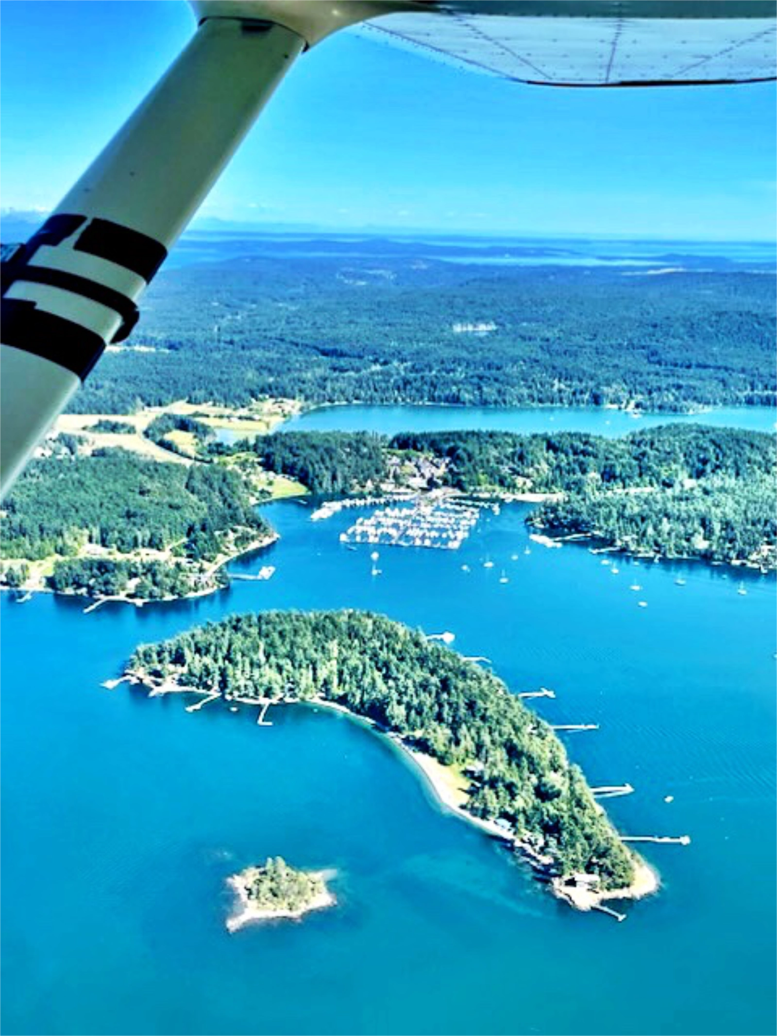
A narrow channel allows boats in a marina to exit into open water around the islands. Photo by Frances Robertson.

In addition to marinas, many boats sit in anchorage areas when visiting the islands. Understanding the impact they have on sea grass is one of the reasons for the study. Photo by Frances Robertson.
Flying the transects themselves brings its own challenges. “Ray did a good job helping, because the transects are close together,” Gormley said, referring to fellow LightHawk volunteer pilot Ray. “He extended the ForeFlight legs a little, so we’d know we were in the right area, though since we’re flying higher now that’s less of an issue.” Much of the airspace is uncontrolled, which means pilots rely on landmarks rather than instructions from air traffic control. “You have to learn the nautical landmarks,” he said. “Somebody says ‘we’re over Fisherman’s Bay,’ or ‘I’m at this inlet.’ You have to kind of learn that.”
Asked whether flying the same transects gets tedious, Gormley chuckled. “It doesn’t get tedious, because I’m trying to get as accurate as I can,” he said. “You’ve got winds and everything going on while you’re doing it, so it takes a lot of focus. The legs aren’t that long. You’re probably flying 35 to 45 seconds before you make a turn and come back, so you have to take into account what the winds are doing so you don’t get blown off course and adjust your turn accordingly.”
For Gormley, the flights carry weight beyond the flying itself. Robertson has told him tourism tied to the San Juans’ orca population is a major driver of the local economy, one reason the study matters. “If the whales aren’t there anymore, there are things people will stop coming to the islands for,” he said. “You have to be a good steward of the area you’re in.” It’s that kind of insight that keeps him coming back. “I like it for the education,” he said. “Every flight, I learn something from the people I’m with, something about the area you didn’t know before.”
Lane Gormley’s experience flying the San Juan Islands continues to shape the project’s success. LightHawk is grateful for his commitment to this work and to the marine ecosystem it protects.
Photos by Frances Robertson.