Flying Montana’s Bitterroot Valley

The West Fork of the Bitteroot River in Montana’s Bitterroot Valley is the site of a proposed rare earth minerals mine. The location poses a threat to the headwaters, risking impacts to communities, wildlife and agricultural operations downstream. Photo by Keila Szpaller.

“Ray Lee is a true professional.” 

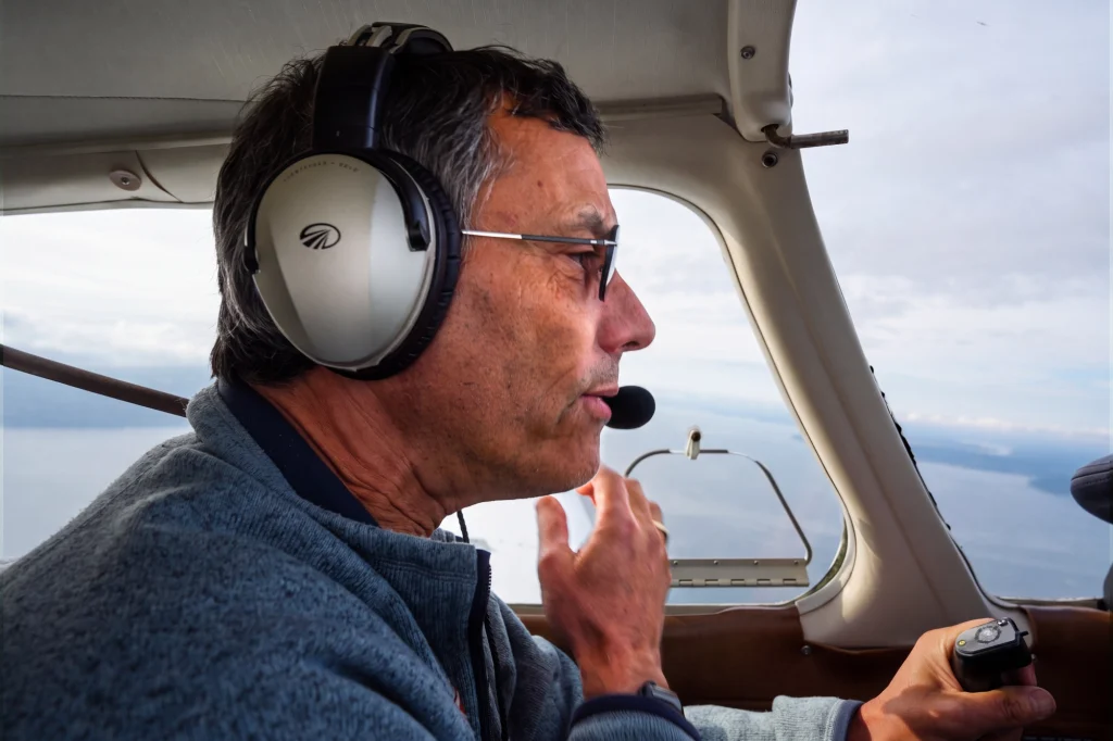
That’s how Northern Rockies Program Manager Chris Boyer described to Lee after a recent LightHawk mission through Montana’s Bitterroot Valley. Lee and Boyer teamed up to provide aerial tours of a proposed mine site near the Headwaters of the Bitterroot Valley – a winding waterway that flows through picturesque country featured in TVs Yellowstone drama series.

The mission brought elected officials, journalists, and community stakeholders into the air with the Bitterroot Water Partnership to see a proposed mine site near the headwaters of the Bitterroot River and better understand its potential impacts on the surrounding landscape.

With 10 participants, one aircraft wasn’t enough. Boyer flew his own plane and recruited Lee and his Cessna 182 to help. For Lee, that meant an early departure from Wyoming and a roughly 250-nautical-mile trip north to the Stevensville Airport in Montana.

Bitterroot Water Partnership assembled a group that included media, elected officials and local stakeholders to take part in the aerial tour. Photo by Keila Szpaller.

Painted Rocks Reservoir, downstream of the proposed mine site, is a major source of water for the entire Bitterroot Valley. Photo by Keila Szpaller.

Preflight planning required a little more thought than a typical local mission. Lee had roughly 250 nautical miles to cover just to reach Stevensville, making weather, timing and efficiency especially important.

“You’re doing a full 2 to 2.5-hour flight, and you want to make sure you’re able to get in at the time you’re committed to,” Lee said. “So it’s a bit more planning than a local flight.”

The weather cooperated on the way north. The return trip was another story.

“We’re flying in the summer, in the afternoon, in the mountains, so you’re always going to get something there,” Lee said. “It was a little rough going back.”

From Stevensville, Lee and Boyer flew south through the valley and up the West Fork of the Bitterroot River toward the proposed mine site. Passenger assignments were planned in advance based on aircraft capacity and weight, with the two pilots completing two rounds of flights. 

The Bitterroot Valley missions were out-and-back flights from Stevensville Airport. Lee and Boyer flew south through the valley before following the West Fork of the Bitterroot River to the proposed mine site. With 10 participants, the pilots divided passengers between their two aircraft based on weight and capacity. Lee carried three passengers in his Cessna 182 and Boyer carried two, requiring two rounds of flights.

The Bitterroot River (foreground) winds through the valley supporting wildlife and fishing that attracts tourists from around the country. Photo by Keila Szpaller.

The Bitterroot Valley’s agricultural operations are a significant portion of its economy and depend on clean water from the Bitterroot River. Photo by Keila Szpaller.

“We had the flight leader in my aircraft, talking about where we were flying, what we were seeing, and where we were going next. We broadcast that to both aircraft, and everyone had headsets. I was able to fly close enough to Chris that both planes were essentially looking at the same things at the same time.” 

“We flew from Stevensville to the mine site, probably 70 miles. Once there, we dropped into the canyon to get a closer look at where the mine and its supporting activities would be located.” 

That closer view helped passengers understand the potential scale of the project and the impacts of moving equipment and materials into and out of the site. 

“It was a pretty typical group. We had a newspaper columnist, people from the Bitterroot Water Partnership, and a couple of county commissioners. That’s how I like to see LightHawk missions come together, with people bringing different perspectives and seeing the same things at the same time. It gives everyone a chance to talk through what’s happening and hopefully come to a better understanding.” 

“Going in and out, we were probably about 2,000 feet above ground level,” he said. “They’re both small aircraft and don’t climb all that well at that altitude, so you want to give yourself a little bit of room.” 

Summer heat added another consideration, with higher density altitude affecting aircraft performance. 

He explained the thinking further: “They’re both small aircraft and don’t climb all that well at that altitude, so you want to give yourself a little bit of room.” Summer heat added another consideration, with higher density altitude affecting aircraft performance.

After the flights, passengers had time to talk and ask questions. Lee said the response was encouraging.“People wanted to get additional information. We got to see everything the group wanted to see, and there was a lot of business card exchanging, with people saying, ‘I want to learn more about this.’” 

Given the travel to and from Stevensville, Lee logged about seven hours of flight time that day: four hours commuting and another three flying the two missions through the valley. Looking back, he called it “a picture-perfect LightHawk flight.”

“They put together a really good group. We had a filmmaker, a journalist, and a couple of county commissioners. Sometimes elected officials will say, ‘I’m too busy,’ but these guys showed up interested. From that point of view, I thought the flights went very well.” 

Lee felt the aerial perspective helped passengers understand both the character of the landscape and the potential reach of the proposed mine. “I think people got the idea that this is a pretty special place,” he said. “A mine of the size being discussed could have a very significant impact on the entire valley.” 

Daily Montanan journalist Keila Szpaller echoed that after the flight: 

“I was offered a chance to see the Bitterroot Valley and the West Fork in a way that puts a proposed mine in a wider context. I don’t believe this would be possible without the support of LightHawk. I saw where the water comes from and where it flows, and where a mine might be placed in relation to the headwaters.” 

Ray Lee is a wildlife biologist by profession, and that background shapes why he flies for LightHawk. “Wildlife, wild areas, conservation and resource management are important to me. LightHawk is very effective at showing decision makers things they simply can’t see from the ground. Being able to give people that perspective is one of the great things about LightHawk and the mission it fulfills.”

After 25 years of flying for LightHawk, Ray is still helping people see conservation challenges from a different perspective. We’re grateful for his extraordinary commitment to LightHawk and conservation flying, and glad he’s not done yet. 

Photos by Keila Szpaller and Shelley Irwin.

Share This