
WATERSHEDS
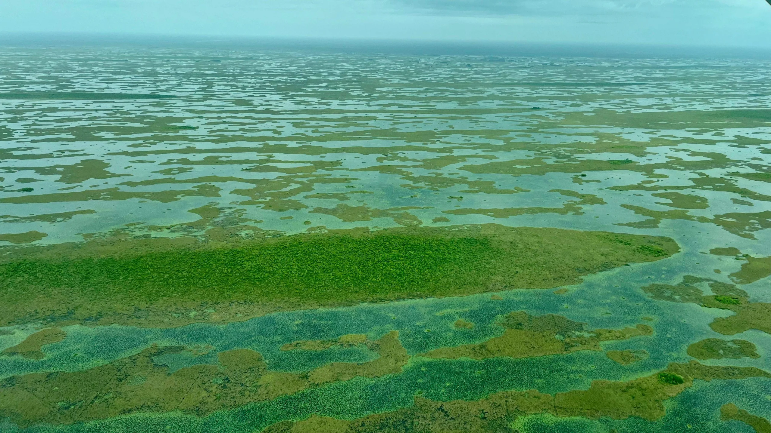
Seeing One Connected System
From Lake Okeechobee to Florida Bay, LightHawk provides the planning, access and aerial perspective needed to understand changing conditions and advance conservation across South Florida.
The Commitment
Following the Water
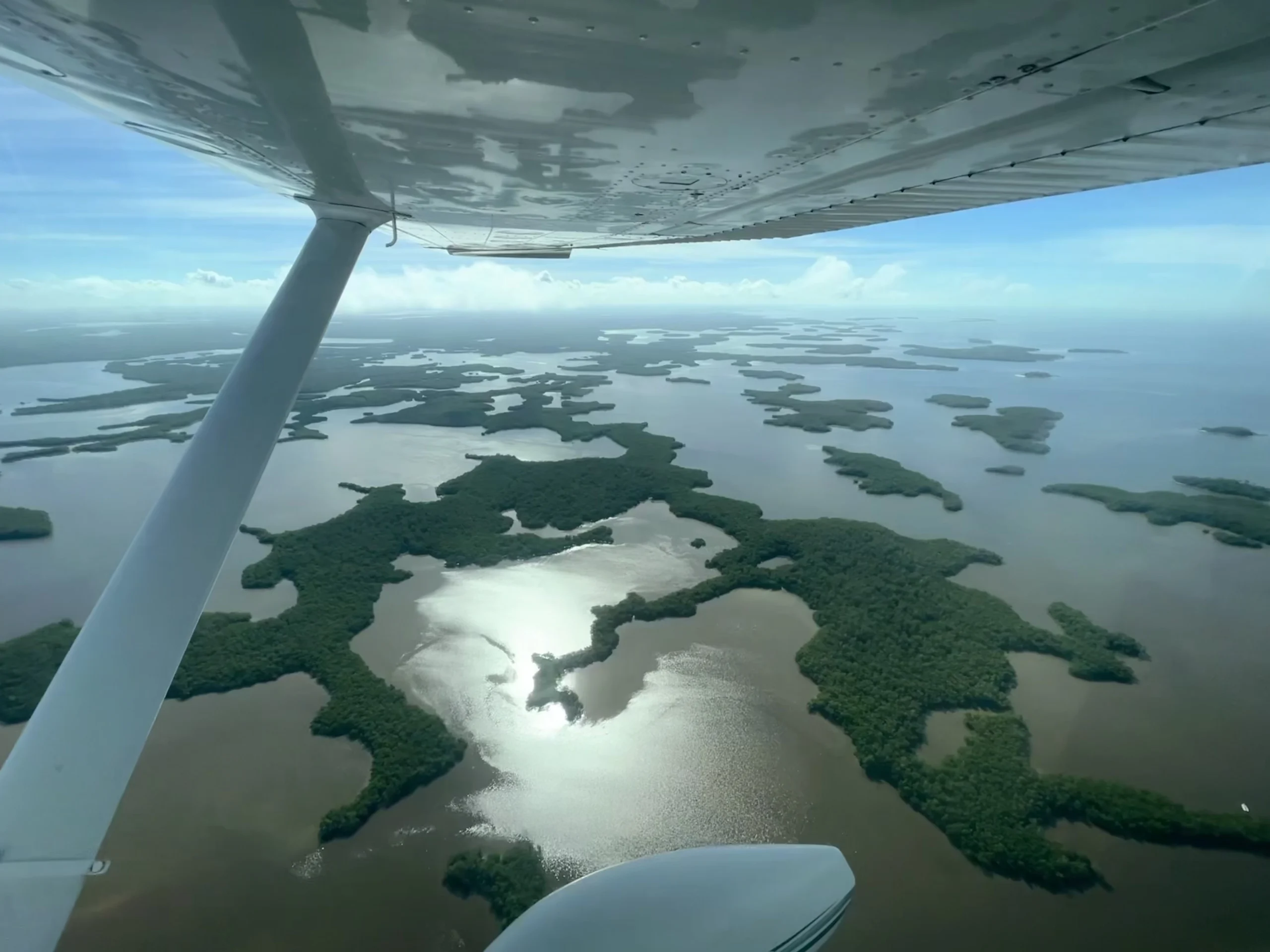
The Everglades is more than a single landscape. Water connects Lake Okeechobee, wetlands, estuaries, coastal communities, Florida Bay and the wildlife habitats between them. A change in one place can affect the entire system.
LightHawk works alongside researchers, conservation organizations, journalists and public agencies to reveal those connections. Our flights document change over time, support science and restoration, bring decision-makers into the landscape and help the public understand what is happening across places that can be difficult to see from the ground.
THE IMPACT
Our sustained work across the Everglades strengthens science, guides restoration and habitat protection, brings urgent threats to light and connects vulnerable wildlife with specialized care.
-

Document Changing Conditions
Create visual records of algal blooms, drought, wildfire, development and habitat change to compare over time.
-

Guide Research and Restoration
Provide scientists and conservation teams with landscape-scale information that supports monitoring, restoration planning and wildlife recovery.
-

Inform Decisions and Public Understanding
Bring decision-makers, researchers, and journalists into the landscape so complex conservation issues become understandable and actionable.
the work in action
Impact Across the Everglades
Through a sustained commitment to the Everglades, LightHawk strengthens the science, decisions and public support needed to restore and protect its connected waters, wetlands, coasts and wildlife habitat.
Tracking Harmful Algal Blooms
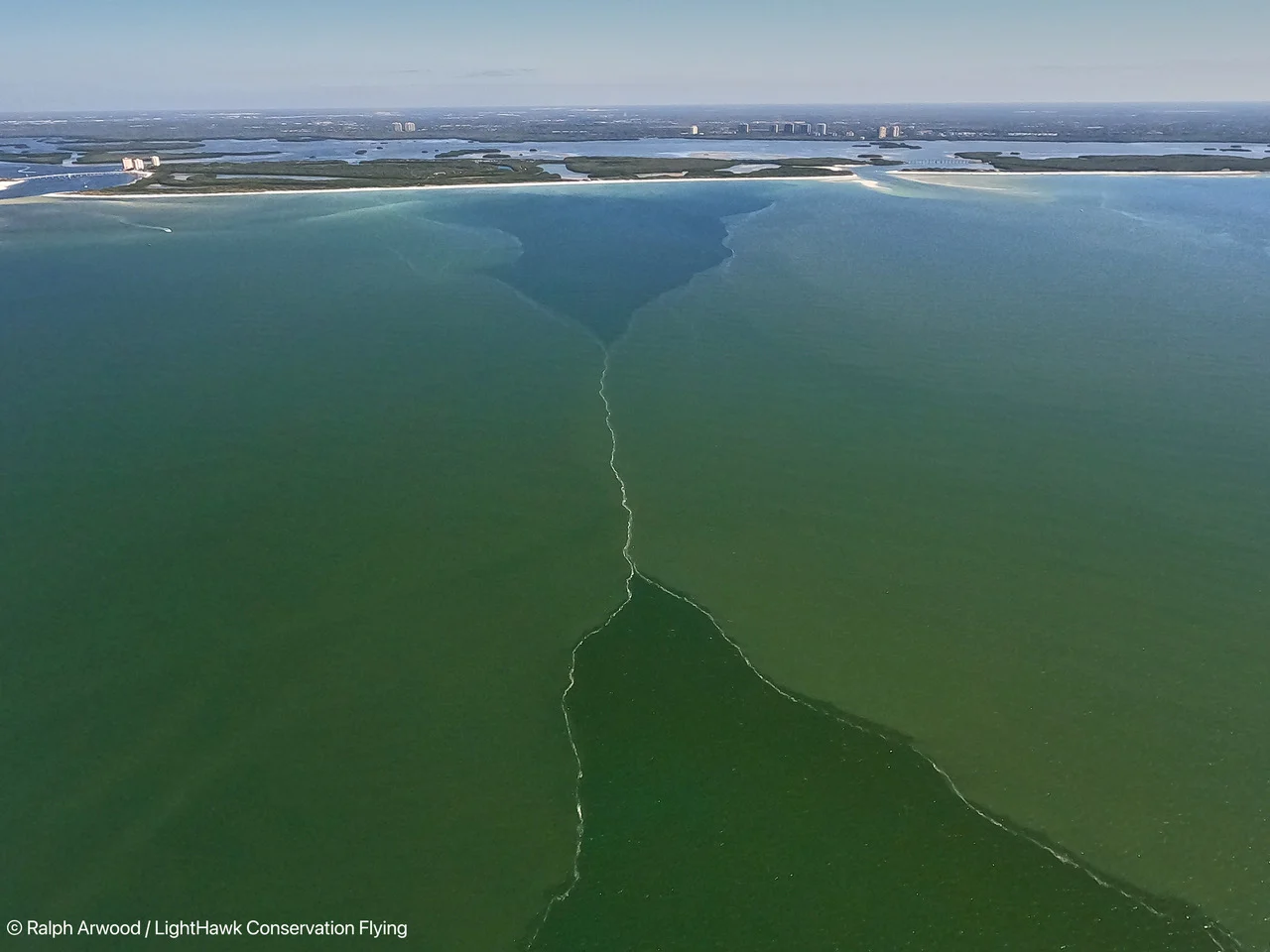
Year after year, we return to Lake Okeechobee, its connected rivers and Florida Bay to document harmful algal blooms and changing water conditions. This sustained record helps researchers compare conditions over time, understand how problems move through the system and keep water quality before the public and policymakers.
Monitoring Coastal Waters
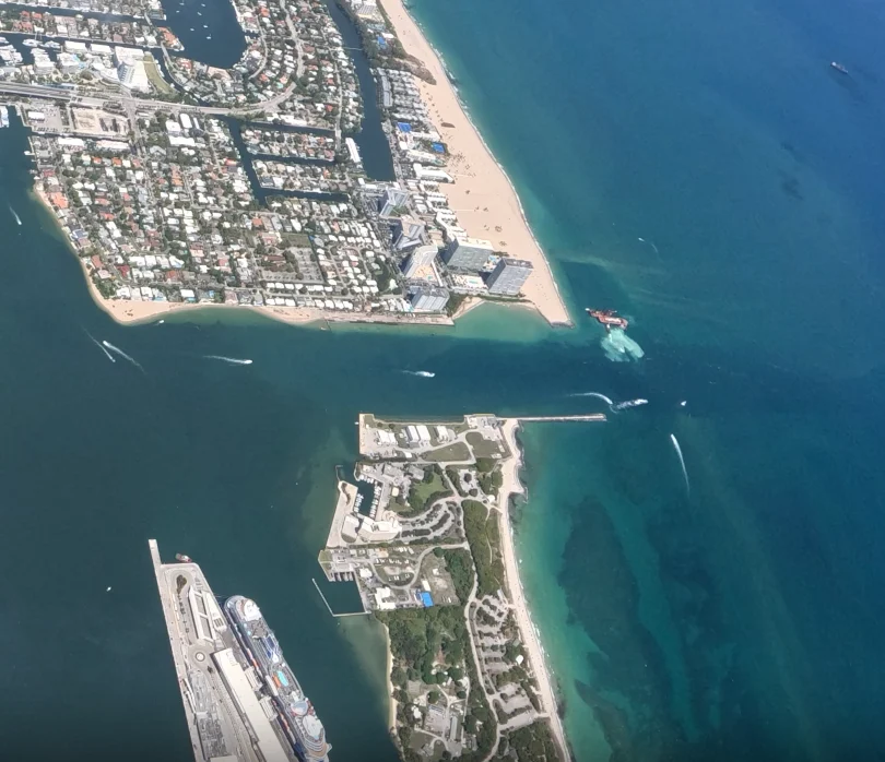
Over months of recurring missions, we worked with Miami Waterkeeper to document dredging activity and reported sediment plumes near coral habitat at Port Everglades. The dated record provided a comparison of conditions to guide further investigation and communicate concerns to agencies. Miami Waterkeeper secured a temporary halt to dredging upon further review.
Building Support for Restoration
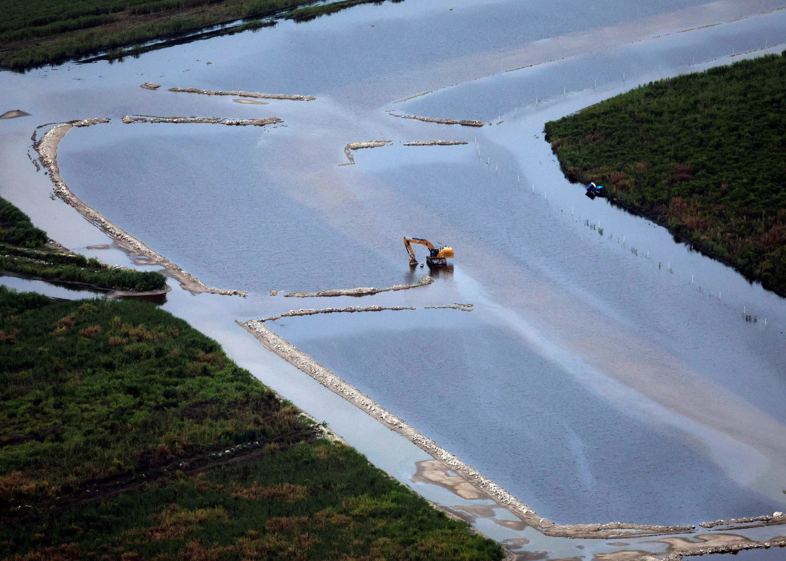
Over years of work alongside The Everglades Foundation, we have documented major restoration projects and their connections across the system. That work has informed coverage in the Miami Herald, Associated Press, Sun Sentinel and other outlets, helping audiences understand the scale of restoration and why continued investment matters.
Tracking Wood Stork Recovery
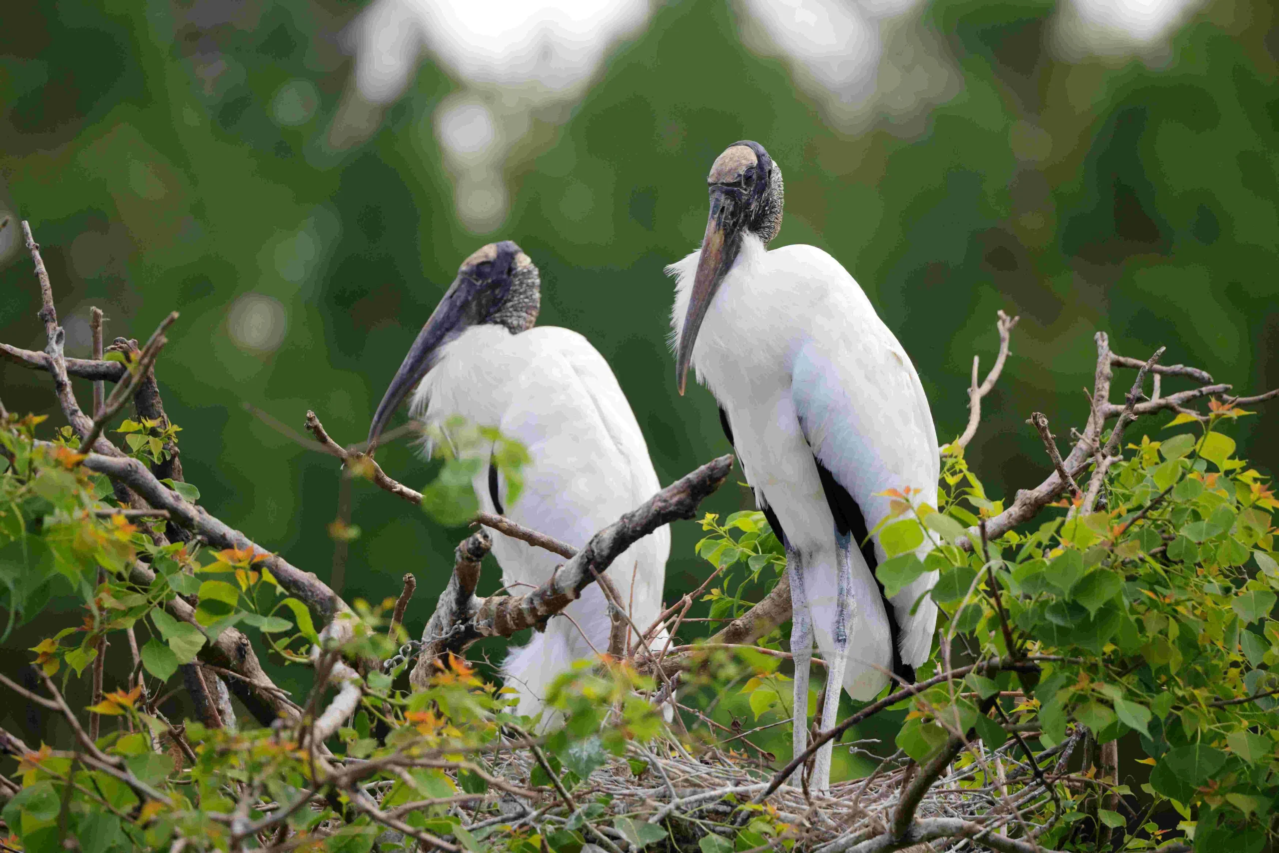
Long-term aerial monitoring has tracked wood stork nesting in the Everglades and at colony sites across Florida. By returning to known colonies, the surveys document nesting activity, estimate chick numbers and create imagery for digital nest counts, building the consistent record needed to measure recovery and inform decisions about the species’ protected status.
our partners and COLLABORATORS
Working Across the Everglades
-

-
 Bonefish & Tarpon Trust
-
 Captains for Clean Water
-
 Conservancy of Southwest Florida
-
 Embry-Riddle Aeronautical University
-
 Florida International University
-

-

-
 Rivers Coalition
-
 Save the Manatee Club
-
 Sun Sentinel
-
 Surfrider Foundation
-
 The Everglades Foundation
-
 The Miami Herald
-
 US Fish & Wildlife Service
Help Protect the Everglades.
Your support keeps LightHawk flying across the Everglades to track change, strengthen research and respond when conservation action depends on timely information.